Latitude: 50.7313 / 50°43'52"N
Longitude: -1.1595 / 1°9'34"W
OS Eastings: 459415
OS Northings: 92742
OS Grid: SZ594927
Mapcode National: GBR 9CN.1P7
Mapcode Global: FRA 87G4.VG8
Plus Code: 9C2WPRJR+G6
Entry Name: 37-41, George Street
Listing Date: 18 May 1972
Grade: II
Source: Historic England
Source ID: 1235065
English Heritage Legacy ID: 411212
ID on this website: 101235065
Location: Ryde, Isle of Wight, PO33
County: Isle of Wight
Civil Parish: Ryde
Built-Up Area: Ryde
Traditional County: Hampshire
Lieutenancy Area (Ceremonial County): Isle of Wight
Church of England Parish: Oakfield St John
Church of England Diocese: Portsmouth
Tagged with: Building
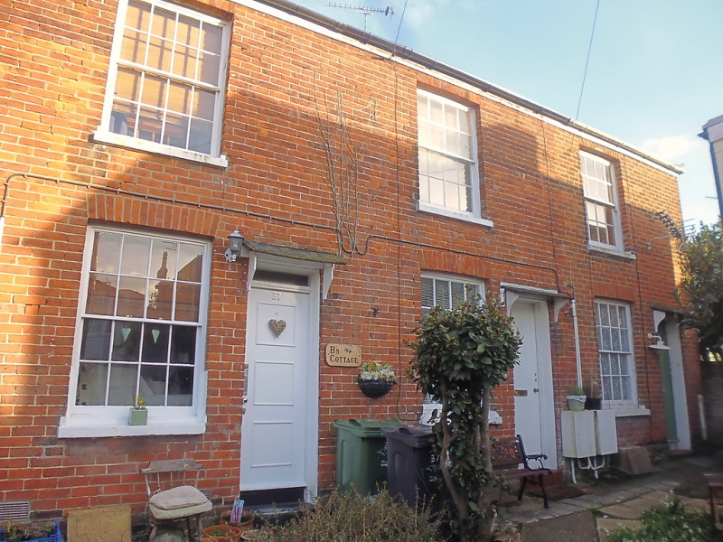
GEORGE STREET
1.
1577 (East Side)
SZ 5992 2/201 Nos 37 to 41 (odd)
II GV
2.
Part of same group as Nos 29 to 35. Three cottages as one house also in red
brick with grey headers of two storeys with hipped slate roof. Three
windows, recessed sash, glazing bars, block sills. Doors have four
incised panels, bracketed hoods.
Nos 29 to 43 (odd) form a group.
Listing NGR: SZ5941592742
External links are from the relevant listing authority and, where applicable, Wikidata. Wikidata IDs may be related buildings as well as this specific building. If you want to add or update a link, you will need to do so by editing the Wikidata entry.


Other nearby listed buildings