Latitude: 51.506 / 51°30'21"N
Longitude: -0.1394 / 0°8'21"W
OS Eastings: 529227
OS Northings: 180202
OS Grid: TQ292802
Mapcode National: GBR DG.WB
Mapcode Global: VHGQZ.JDNV
Plus Code: 9C3XGV46+96
Entry Name: 2 and 3, St James's Place
Listing Date: 20 May 1969
Grade: II
Source: Historic England
Source ID: 1235672
English Heritage Legacy ID: 426477
ID on this website: 101235672
Location: St James's, Westminster, London, SW1A
County: London
District: City of Westminster
Electoral Ward/Division: St James's
Parish: Non Civil Parish
Built-Up Area: City of Westminster
Traditional County: Middlesex
Lieutenancy Area (Ceremonial County): Greater London
Church of England Parish: St James Piccadilly
Church of England Diocese: London
Tagged with: Building
This list entry was subject to a Minor Enhancement on 19 March 2025 to amend the description and reformat the text to current standards.
TQ 2980 SW
81/77
CITY OF WESTMINSTER
ST JAMES'S PLACE SW1
Nos 2 and 3
20.5.69
GV
II
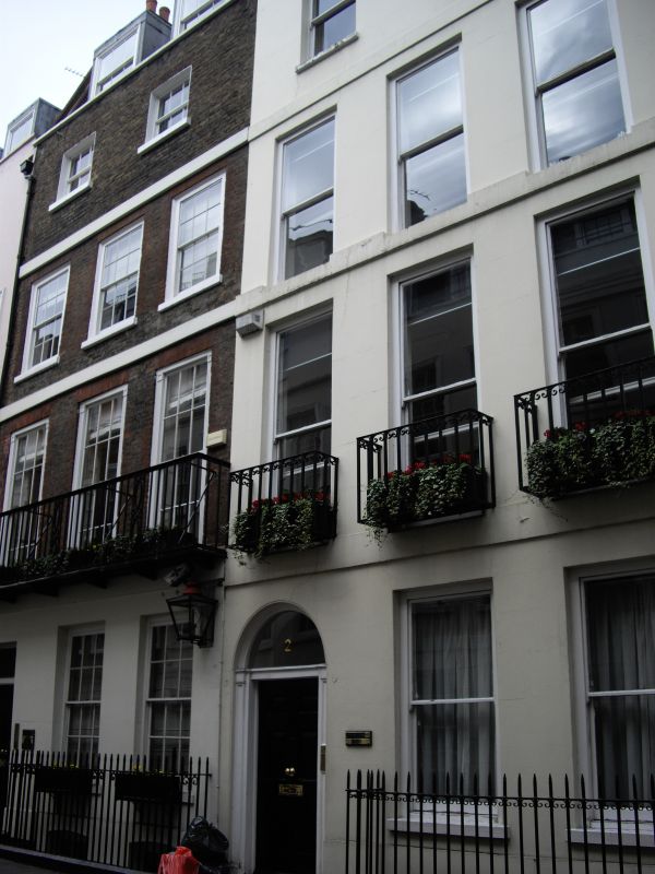
Terrace houses. Part of c.1685 row. Brown brick originally, stuccoed early C19, slate roof. Four storeys and dormered mansard. Each front three windows wide. Square headed doorway to right with rectangular fanlight, six-panel door. Nearly flush framed sash windows, no glazing bars, slightly cambered heads. Bands between storeys and parapet with coping. Cast iron balconies to first floor.
Interior has some of original panelling and box cornices to ground and 1st floors; dog leg, closed string, turned baluster staircase.
There is a wall-mounted Windsor gas lantern to the front elevation between Numbers 2 and 3. This had been installed by 1977 as it can be seen in a photograph of that date held by the London Picture Archive.
Listing NGR: TQ2922780206
External links are from the relevant listing authority and, where applicable, Wikidata. Wikidata IDs may be related buildings as well as this specific building. If you want to add or update a link, you will need to do so by editing the Wikidata entry.


Other nearby listed buildings