Latitude: 52.9454 / 52°56'43"N
Longitude: -0.6164 / 0°36'59"W
OS Eastings: 493068
OS Northings: 339563
OS Grid: SK930395
Mapcode National: GBR DPS.70T
Mapcode Global: WHGKH.H7PB
Plus Code: 9C4XW9WM+5C
Entry Name: Implement Shed Granary and Stable 75 Metres South of Home Farmhouse
Listing Date: 21 September 1979
Grade: II
Source: Historic England
Source ID: 1236234
English Heritage Legacy ID: 382935
ID on this website: 101236234
Location: Belton, South Kesteven, Lincolnshire, NG32
County: Lincolnshire
District: South Kesteven
Civil Parish: Belton and Manthorpe
Traditional County: Lincolnshire
Lieutenancy Area (Ceremonial County): Lincolnshire
Church of England Parish: Belton St Peter and St Paul
Church of England Diocese: Lincoln
Tagged with: Agricultural structure
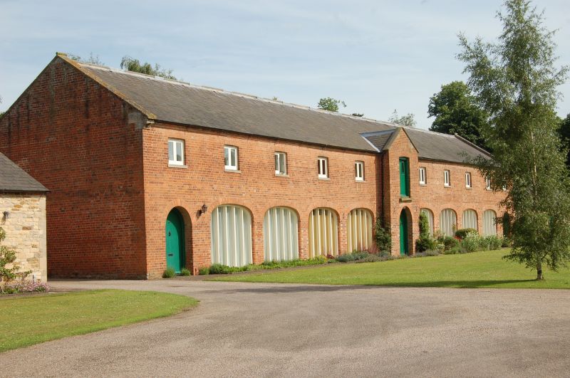
BELTON & MANTHORPE SK9339 MAIN STREET, Belton 1315-0/9/62 (East side) 21/09/79 Implement Shed, Granary & Stable, 75m south of Home Farmhouse II
Implement shed and granary, and adjoining stable. Early C19. Brick and coursed squared stone, with ashlar dressings and slate roofs. Brick fronted implement shed, to left, has coped gables. 2 storeys; 11 window range. Projecting central gabled bay with a segment arched loft door above, and a round arched doorway below. Beyond, on either side, 5 small square segment arched louvred ventilators. Below, 4 elliptical arched cart entrances with square piers, that to the far right with double board doors. Beyond, smaller round arched doorways. Single storey stable, to right, has a hipped roof. Central blocked door flanked by single windows, and beyond, a smaller window to left, and a door to right. All have segmental heads.
Listing NGR: SK9306839563
External links are from the relevant listing authority and, where applicable, Wikidata. Wikidata IDs may be related buildings as well as this specific building. If you want to add or update a link, you will need to do so by editing the Wikidata entry.


Other nearby listed buildings