Latitude: 52.946 / 52°56'45"N
Longitude: -0.6163 / 0°36'58"W
OS Eastings: 493070
OS Northings: 339631
OS Grid: SK930396
Mapcode National: GBR DPS.70L
Mapcode Global: WHGKH.H6QV
Plus Code: 9C4XW9WM+CF
Entry Name: Home Farmhouse Ad Adjoining Boundary Wall
Listing Date: 21 September 1979
Last Amended: 14 November 1994
Grade: II
Source: Historic England
Source ID: 1187954
English Heritage Legacy ID: 382932
ID on this website: 101187954
Location: Belton, South Kesteven, Lincolnshire, NG32
County: Lincolnshire
District: South Kesteven
Civil Parish: Belton and Manthorpe
Traditional County: Lincolnshire
Lieutenancy Area (Ceremonial County): Lincolnshire
Church of England Parish: Belton St Peter and St Paul
Church of England Diocese: Lincoln
Tagged with: Farmhouse
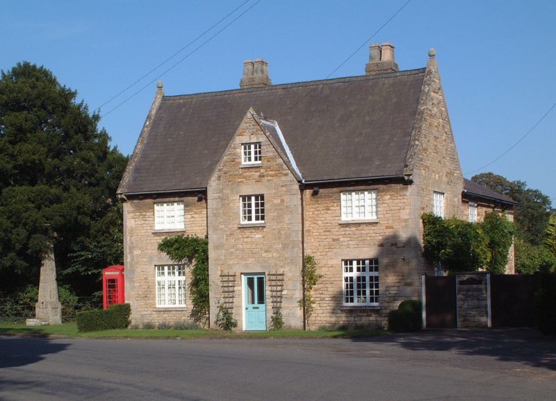
BELTON & MANTHORPE SK9339 MAIN STREET, Belton 1315-0/9/59 (East side) 21/09/79 Home Farmhouse and adjoining boundary wall (Formerly Listed as: VILLAGE STREET Home Farmhouse) II
Farmhouse, now a house, and adjoining boundary wall. Early C18, with C19 and mid C20 alterations. Coursed squared stone with ashlar dressings and steep pitched C19 slate roof. 2 brick rear wall stacks. Quoins, dentillated eaves, coped gables with kneelers and finials. Openings have stone lintels. 2 storeys plus attics; 3 window range. Windows are mainly mid C20 glazing bar casements. Projecting central entrance bay has a coped gable. 2-light window, and above, a similar smaller window. Renewed 6-panel door with 2 glazed panels. Beyond, on either side, a 3-light window, and below, larger 3-light cross casements. Left gable has a blank on each floor. INTERIOR is said to contain an early C18 staircase with twist balusters. To right, a coursed squared stone boundary wall with slab coping, approx 40m long. Next to the house, a doorway, and to right, a gateway to the former farm yard. (Kerr M: Survey notes on National Trust properties in Belton: 1985-1989).
Listing NGR: SK9307039631
External links are from the relevant listing authority and, where applicable, Wikidata. Wikidata IDs may be related buildings as well as this specific building. If you want to add or update a link, you will need to do so by editing the Wikidata entry.


Other nearby listed buildings