Approximate Location Map
Large Map »
Latitude: 52.0568 / 52°3'24"N
Longitude: 1.1546 / 1°9'16"E
OS Eastings: 616364
OS Northings: 244526
OS Grid: TM163445
Mapcode National: GBR TMW.4Q0
Mapcode Global: VHLBS.YKQL
Plus Code: 9F433543+PR
Entry Name: 3, St Stephens Lane
Listing Date: 15 December 1977
Grade: II
Source: Historic England
Source ID: 1236894
English Heritage Legacy ID: 428019
ID on this website: 101236894
Location: Ipswich, Suffolk, IP1
County: Suffolk
District: Ipswich
Electoral Ward/Division: Alexandra
Parish: Non Civil Parish
Built-Up Area: Ipswich
Traditional County: Suffolk
Lieutenancy Area (Ceremonial County): Suffolk
Church of England Parish: Ipswich St Mary-le-Tower
Church of England Diocese: St.Edmundsbury and Ipswich
Tagged with: Building
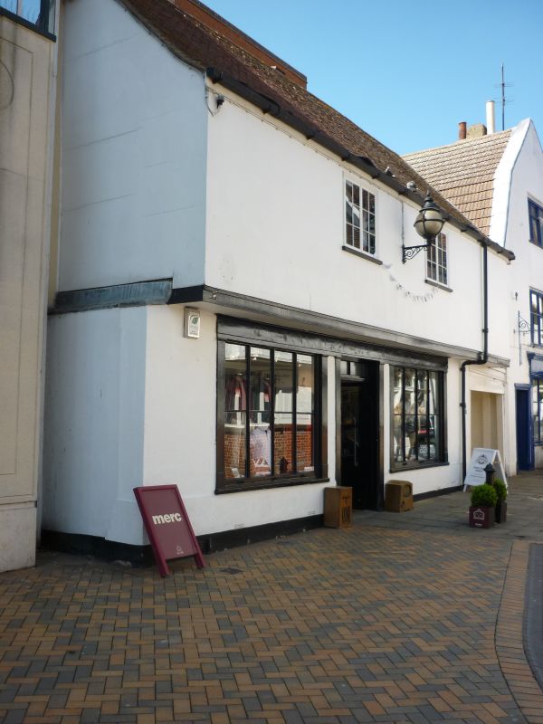
ST STEPHENS LANE
1.
5379 (West Side)
No 3
TM 1644 NW 1/239
II
2.
A timber-framed and plastered building of C17 origin, with a jettied upper storey.
Altered in the C19. 2 storeys. 2 window range, casements. The ground storey has
a boarded up shop front. Roof tiled.
Listing NGR: TM1636444526
External links are from the relevant listing authority and, where applicable, Wikidata. Wikidata IDs may be related buildings as well as this specific building. If you want to add or update a link, you will need to do so by editing the Wikidata entry.


Other nearby listed buildings
