Latitude: 51.2357 / 51°14'8"N
Longitude: 1.344 / 1°20'38"E
OS Eastings: 633527
OS Northings: 153819
OS Grid: TR335538
Mapcode National: GBR X1N.JKY
Mapcode Global: VHLGZ.76VJ
Plus Code: 9F3368PV+7H
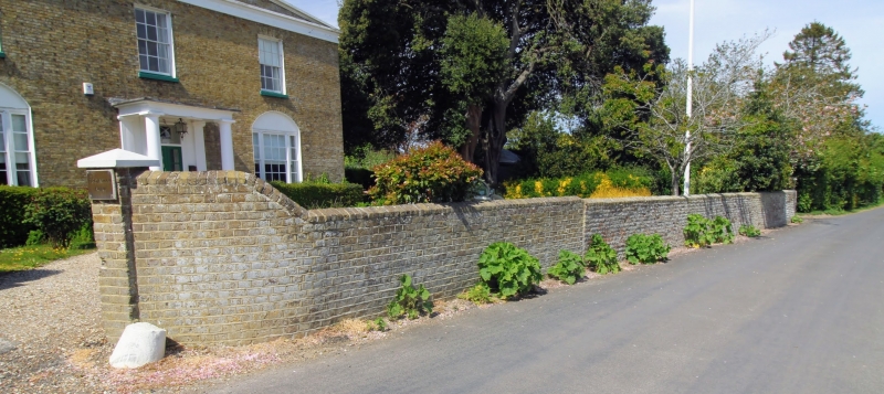
Entry Name: Wall About 15 Metres South-East of Finglesham Farmhouse
Listing Date: 24 March 1987
Grade: II
Source: Historic England
Source ID: 1236995
English Heritage Legacy ID: 428134
ID on this website: 101236995
Location: Finglesham, Dover, Kent, CT14
County: Kent
District: Dover
Civil Parish: Northbourne
Traditional County: Kent
Lieutenancy Area (Ceremonial County): Kent
Tagged with: Wall
NORTHBOURNE MARLEY LANE TR 35 SW (west side) 4/20 Wall about 15 metres south-east of Finglesham Farmhouse
GV II
Wall. C18 and early C19. White and red brick in 2 builds. Gate piers to left, with wall ramped from 6 feet down to 4 feet, and sweeping out to road. Extending about 10 metres in white brick, then 25 metres in red brick along road front, terminating at north end with 2 capped gate piers.
Listing NGR: TR3342254098
External links are from the relevant listing authority and, where applicable, Wikidata. Wikidata IDs may be related buildings as well as this specific building. If you want to add or update a link, you will need to do so by editing the Wikidata entry.


Other nearby listed buildings