Latitude: 51.2283 / 51°13'41"N
Longitude: 1.3093 / 1°18'33"E
OS Eastings: 631144
OS Northings: 152880
OS Grid: TR311528
Mapcode National: GBR X1M.V4Q
Mapcode Global: VHLGY.ND08
Plus Code: 9F3368H5+8P
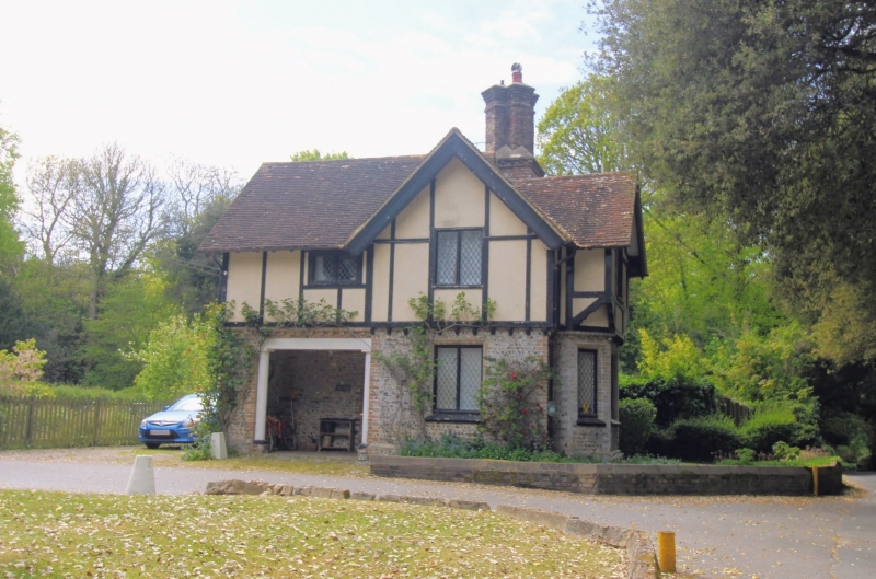
Entry Name: Gate Lodge to Betteshanger House
Listing Date: 24 March 1987
Grade: II
Source: Historic England
Source ID: 1237084
English Heritage Legacy ID: 428119
ID on this website: 101237084
Location: Betteshanger, Dover, Kent, CT14
County: Kent
District: Dover
Civil Parish: Northbourne
Traditional County: Kent
Lieutenancy Area (Ceremonial County): Kent
Tagged with: Gatehouse
NORTHBOURNE BETTESHANGER TR 35 SW
4/5 Gate Lodge to Betteshanger House
II
Gate Lodge. Late C19. Probably by George Devey. Flint and brown brick with rendered and framed upper section. Plain tiled roof. Two storeys and gabled with projecting gables and central stack cluster. Canted bay on main ground floor with wooden casements irregularly placed elsewhere. Pillared recess in rear elevation with original L-shaped rustic bench fitting, and boarded four centred arched doorway.
Listing NGR: TR3296653033
External links are from the relevant listing authority and, where applicable, Wikidata. Wikidata IDs may be related buildings as well as this specific building. If you want to add or update a link, you will need to do so by editing the Wikidata entry.


Other nearby listed buildings