Latitude: 52.058 / 52°3'28"N
Longitude: 1.1438 / 1°8'37"E
OS Eastings: 615618
OS Northings: 244626
OS Grid: TM156446
Mapcode National: GBR TMP.VC7
Mapcode Global: VHLBS.SJ0N
Plus Code: 9F43345V+6G
Entry Name: Firbank
Listing Date: 4 August 1994
Grade: II
Source: Historic England
Source ID: 1237505
English Heritage Legacy ID: 428801
ID on this website: 101237505
Location: Ipswich, Suffolk, IP1
County: Suffolk
District: Ipswich
Electoral Ward/Division: Gipping
Parish: Non Civil Parish
Built-Up Area: Ipswich
Traditional County: Suffolk
Lieutenancy Area (Ceremonial County): Suffolk
Church of England Parish: St Matthew Triangle and All Saints
Church of England Diocese: St.Edmundsbury and Ipswich
Tagged with: Building
IPSWICH
TM1544 DALTON ROAD
642-0/5/10016 (South side)
No.25
Firbank
II
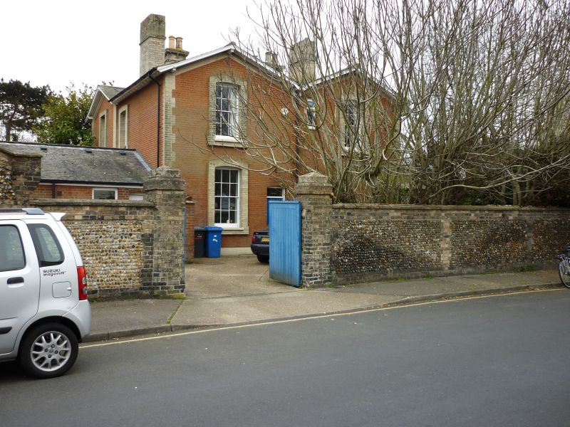
House. 1854. Red brick with white-brick dressings. Slate
roofs. 2 storeys. W front has a 3-window range, the windows
being 6/6 unhorned sashes set within projecting architraves.
Outer 2 windows have small gables to the roof. Central stone
porch with profuse low-relief decorative carving. South front
has 2 canted window bays fitted with 1/1 sashes. North front
to street presents 2 gables, each with a 6/6 unhorned sash to
each floor set within projecting architraves. Simple doorway.
Gabled roofs studded with low chimneystacks at intervals.
Stables connect to house at north-east corner, converted to
garage use.
INTERIOR: staircase with cast-iron balusters and a ramped and
wreathed timber handrail. 4-panelled internal doors. Rear hall
with plaster ceiling in geometric pattern.
Listing NGR: TM1561844626
External links are from the relevant listing authority and, where applicable, Wikidata. Wikidata IDs may be related buildings as well as this specific building. If you want to add or update a link, you will need to do so by editing the Wikidata entry.


Other nearby listed buildings