Latitude: 52.0594 / 52°3'33"N
Longitude: 1.1439 / 1°8'38"E
OS Eastings: 615623
OS Northings: 244777
OS Grid: TM156447
Mapcode National: GBR TMP.VD1
Mapcode Global: VHLBS.SH3M
Plus Code: 9F43345V+QH
Entry Name: 12 and 14, Burlington Road
Listing Date: 15 December 1977
Grade: II
Source: Historic England
Source ID: 1264661
English Heritage Legacy ID: 427281
ID on this website: 101264661
Location: Ipswich, Suffolk, IP1
County: Suffolk
District: Ipswich
Electoral Ward/Division: Gipping
Parish: Non Civil Parish
Built-Up Area: Ipswich
Traditional County: Suffolk
Lieutenancy Area (Ceremonial County): Suffolk
Church of England Parish: St Matthew Triangle and All Saints
Church of England Diocese: St.Edmundsbury and Ipswich
Tagged with: Building
BURLINGTON ROAD 1. 5379 (North-West Side) Nos 12 and 14 TM 1544 5/388 II GV
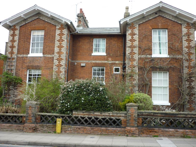
2. A pair of mid-late C19 red brick houses with white brick rusticated quoins and centre dividing strip. The buidlding comprises a central square block with side wings on the north-east and south-west ends. 3 storeys and basements on the centre block and 2 storeys on the wings. 2:2:2 window range, double-hung sashes with glazing bars, in stucco shouldered architraves, with cornices to the ground and 1st storey windows on the centre block. 6-panel doors have semi-circular fanlights and stucco arches with a semi-circular headed window above. The doorway and window above are slightly recessed. Roofs slate, hipped on the centre block with a wood modillion eaves cornice and with a moulded wood eaves cornice to the side wings.
Listing NGR: TM1562344777
External links are from the relevant listing authority and, where applicable, Wikidata. Wikidata IDs may be related buildings as well as this specific building. If you want to add or update a link, you will need to do so by editing the Wikidata entry.


Other nearby listed buildings