Latitude: 52.0658 / 52°3'56"N
Longitude: -0.3279 / 0°19'40"W
OS Eastings: 514715
OS Northings: 242140
OS Grid: TL147421
Mapcode National: GBR H4G.FWS
Mapcode Global: VHGN5.8BHQ
Plus Code: 9C4X3M8C+8R
Entry Name: 17 and 18, Warden Road
Listing Date: 31 October 1966
Grade: II
Source: Historic England
Source ID: 1238052
English Heritage Legacy ID: 415254
ID on this website: 101238052
Location: Southill, Central Bedfordshire, SG18
County: Central Bedfordshire
Civil Parish: Southill
Traditional County: Bedfordshire
Lieutenancy Area (Ceremonial County): Bedfordshire
Church of England Parish: Southill
Church of England Diocese: St.Albans
Tagged with: Building
TL 1442 SOUTHILL WARDEN ROAD 13/256 Nos 17 and 18 31.10.66
- II
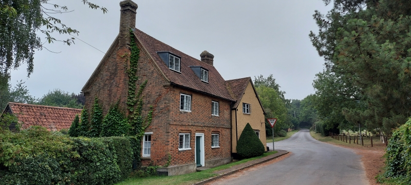
House, formerly 2 properties, belonging to Southill Estate. C17 and Cl8. Earlier S cross-wing is timber framed with colourwashed roughcast render to exterior, and clay tile roof. Later N block is of red brick, with chequered brick front elevation, and clay tile roof. T-plan, N block of 2 storeys and attics, S block of one storey and attics. W elevation: brick block has first floor brick band. 2 box dormers, 2 windows each to first and ground floor, all 2-light leaded casements. 2 plank doors, the RH one a later insertion. LH door and 2 ground floor windows all have flat brick heads, recessed slightly under flat brick arches with rounded angles. Red brick external stack to N gable end. Cross-wing has ground floor bay window with glazing bars, and 2-light leaded casement to attic. Brick double ridge stack.
Listing NGR: TL1471542140
External links are from the relevant listing authority and, where applicable, Wikidata. Wikidata IDs may be related buildings as well as this specific building. If you want to add or update a link, you will need to do so by editing the Wikidata entry.


Other nearby listed buildings