Approximate Location Map
Large Map »
Latitude: 51.0134 / 51°0'48"N
Longitude: -2.4248 / 2°25'29"W
OS Eastings: 370296
OS Northings: 123861
OS Grid: ST702238
Mapcode National: GBR MY.JKGM
Mapcode Global: FRA 56TF.M4T
Plus Code: 9C3V2H7G+83
Entry Name: The Old Bridge
Listing Date: 25 January 1985
Grade: II
Source: Historic England
Source ID: 1238066
English Heritage Legacy ID: 415424
ID on this website: 101238066
Location: Horsington, Somerset, BA8
County: Somerset
District: South Somerset
Civil Parish: Horsington
Built-Up Area: Horsington
Traditional County: Somerset
Lieutenancy Area (Ceremonial County): Somerset
Tagged with: Bridge
ST72SW HORSINGTON CP
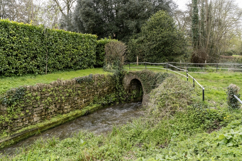
7/44 The Old Bridge
-
GV II
Bridge. C18 or earlier. Local stone rubble, cast iron handrails. Two semi-circular arches, with weir to upstream -
West-side, very thin crown; simple abutments. Handrail formed with thin circular posts and double rods. Important
visual element in the heart of the village, it once carried the main road through the village, which was supplanted
c1877.
Listing NGR: ST7029623861
External links are from the relevant listing authority and, where applicable, Wikidata. Wikidata IDs may be related buildings as well as this specific building. If you want to add or update a link, you will need to do so by editing the Wikidata entry.


Other nearby listed buildings
