Latitude: 51.0131 / 51°0'47"N
Longitude: -2.4246 / 2°25'28"W
OS Eastings: 370307
OS Northings: 123836
OS Grid: ST703238
Mapcode National: GBR MY.JKHS
Mapcode Global: FRA 56TF.M73
Plus Code: 9C3V2H7G+74
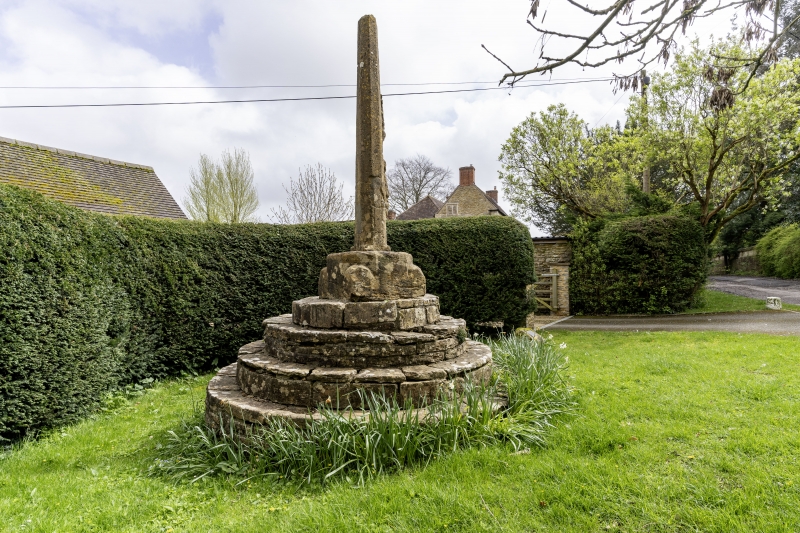
Entry Name: Horsington Village Cross
Listing Date: 24 March 1961
Grade: II
Source: Historic England
Source ID: 1274376
English Heritage Legacy ID: 415423
ID on this website: 101274376
Location: Horsington, Somerset, BA8
County: Somerset
District: South Somerset
Civil Parish: Horsington
Built-Up Area: Horsington
Traditional County: Somerset
Lieutenancy Area (Ceremonial County): Somerset
ST72SW
7/55
HORSINGTON CP
Horsington Village Cross
24.3.61
GV
II
Village Cross. Possibly C13. Ham stone. Stepped circular base about 3 metres diameter at base, rising in 4 steps to about 1.2 metres high; this surmounted by 650mm square base about 450mm high with broached top corners; then octagonal shaft with runout to square, about 300mm wide tapering to 150mm, in all about 3 metres high, the top of the shaft broken: on the South face the remains of a sculptured figure under a canopy, possibly a friar. It may have been a preaching cross; it was certainly the focal point of the former market and fair.
Scheduled Ancient monument (Somerset County No 215). (Pooley, Old Crosses of Somerset, 1877).
Listing NGR: ST7030723836


Other nearby listed buildings