Approximate Location Map
Large Map »
Latitude: 51.3656 / 51°21'55"N
Longitude: 1.4184 / 1°25'6"E
OS Eastings: 638049
OS Northings: 168490
OS Grid: TR380684
Mapcode National: GBR X06.CDT
Mapcode Global: VHMCP.JYQ1
Plus Code: 9F339C89+69
Entry Name: Wall to St Peter's Churchyard
Listing Date: 20 September 1974
Grade: II
Source: Historic England
Source ID: 1239261
English Heritage Legacy ID: 417093
ID on this website: 101239261
Location: St Peter's, Thanet, Kent, CT10
County: Kent
District: Thanet
Civil Parish: Broadstairs and St. Peters
Built-Up Area: Broadstairs
Traditional County: Kent
Lieutenancy Area (Ceremonial County): Kent
Tagged with: Wall
CHURCH STREET
1.
5283
ST PETERS
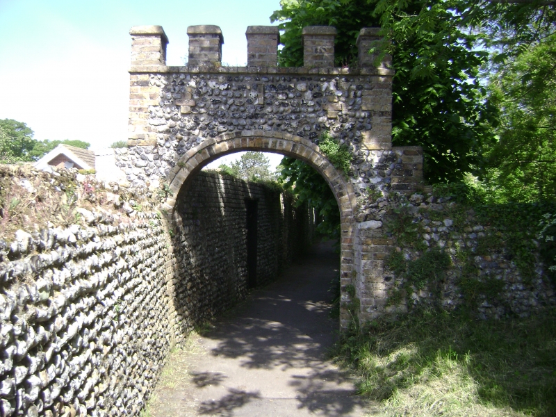
Wall to St Peter's
Churchyard
TR 3868 SW 3/22A
TR 36 NE 5/22A
II
2.
Probably early C19. This is a flint wall, about 6 ft in height with buff brick
pilasters to part. It Incorporates a round-headed arch of buff brick. This has
a crenellated parapet above having 3 brick crosses and a slit.
Listing NGR: TR3804968490
External links are from the relevant listing authority and, where applicable, Wikidata. Wikidata IDs may be related buildings as well as this specific building. If you want to add or update a link, you will need to do so by editing the Wikidata entry.


Other nearby listed buildings
