Latitude: 50.725 / 50°43'29"N
Longitude: -3.5366 / 3°32'11"W
OS Eastings: 291635
OS Northings: 92832
OS Grid: SX916928
Mapcode National: GBR P0.PY2X
Mapcode Global: FRA 37H5.60J
Plus Code: 9C2RPFF7+X9
Entry Name: 36 and 37, Lower North Street
Listing Date: 18 June 1974
Grade: II
Source: Historic England
Source ID: 1239437
English Heritage Legacy ID: 417229
ID on this website: 101239437
Location: Exeter, Devon, EX4
County: Devon
District: Exeter
Electoral Ward/Division: St David's
Parish: Non Civil Parish
Built-Up Area: Exeter
Traditional County: Devon
Lieutenancy Area (Ceremonial County): Devon
Church of England Parish: Exeter St David
Church of England Diocese: Exeter
Tagged with: Building
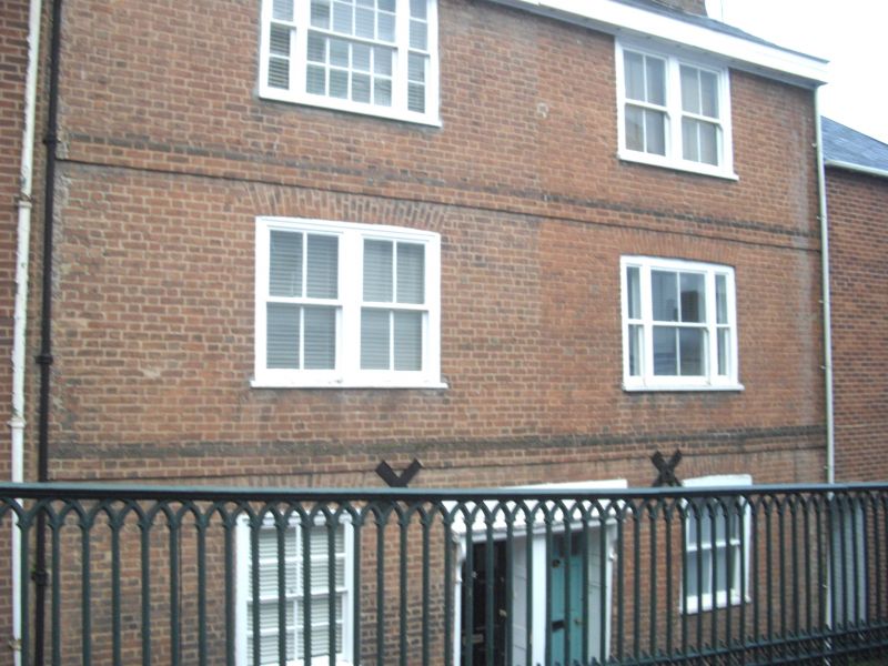
LOWER NORTH STREET 1. 1092 Nos 36 and 37 SX 9192 NE 2/349A II GV 2. Probably C18, 2 storey red brick pair. 3-light sash windows, some glazing bars removed. Linked doorways. Six-panel doors. Slate roof. All the listed buildings of Lower North Street form a group. Nos 28 to 39 (consec) Lower North Street also form a group with No 2 St Davids Hill.
Listing NGR: SX9163592832
External links are from the relevant listing authority and, where applicable, Wikidata. Wikidata IDs may be related buildings as well as this specific building. If you want to add or update a link, you will need to do so by editing the Wikidata entry.


Other nearby listed buildings