Approximate Location Map
Large Map »
Latitude: 50.7398 / 50°44'23"N
Longitude: -1.2764 / 1°16'35"W
OS Eastings: 451152
OS Northings: 93602
OS Grid: SZ511936
Mapcode National: GBR 89Z.G44
Mapcode Global: FRA 8764.4K5
Plus Code: 9C2WPPQF+WC
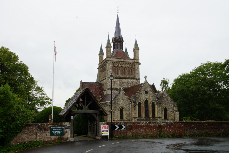
Entry Name: Lychgate to Church of St Mildred
Listing Date: 9 August 1979
Grade: II
Source: Historic England
Source ID: 1239879
English Heritage Legacy ID: 417866
ID on this website: 101239879
Location: St Mildred's Church, Kingston Copse, Isle of Wight, PO32
County: Isle of Wight
Civil Parish: Whippingham
Traditional County: Hampshire
Lieutenancy Area (Ceremonial County): Isle of Wight
Church of England Parish: Whippingham St Mildred
Church of England Diocese: Portsmouth
Tagged with: Lychgate
BEATRICE AVENUE
1.
5270
Whippingham
Lychgate to Church of
St Mildred
SZ 59 SW 7/16
II GV
2.
Circa 1860. Wooden lychgate with gabled tiled roof and king post supports.
Included for group value.
Listing NGR: SZ5115293602
External links are from the relevant listing authority and, where applicable, Wikidata. Wikidata IDs may be related buildings as well as this specific building. If you want to add or update a link, you will need to do so by editing the Wikidata entry.


Other nearby listed buildings
