Approximate Location Map
Large Map »
Latitude: 51.1417 / 51°8'30"N
Longitude: -0.6136 / 0°36'48"W
OS Eastings: 497084
OS Northings: 138966
OS Grid: SU970389
Mapcode National: GBR FDN.7PQ
Mapcode Global: VHFW0.9KZL
Plus Code: 9C3X49RP+MH
Entry Name: Lime Kiln
Listing Date: 28 October 1986
Grade: II
Source: Historic England
Source ID: 1240212
English Heritage Legacy ID: 438316
ID on this website: 101240212
Location: Hambledon, Waverley, Surrey, GU8
County: Surrey
District: Waverley
Civil Parish: Hambledon
Traditional County: Surrey
Lieutenancy Area (Ceremonial County): Surrey
Church of England Parish: Hambledon
Church of England Diocese: Guildford
Tagged with: Lime kiln
SU 93NE HAMBLEDON C.P. CHURCH LANE
9/122 Lime Kiln
II
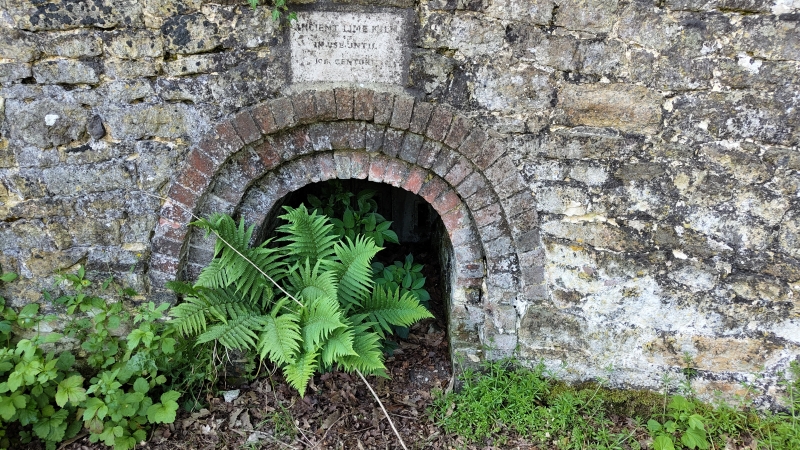
Lime kiln, now disused. C18. Sandstone block with curved front and brick arches
over the round arched entrance. Three-step surround leading to brick lined entrance
tunnel. Access to underground chamber now blocked.
Listing NGR: SU9708438966
External links are from the relevant listing authority and, where applicable, Wikidata. Wikidata IDs may be related buildings as well as this specific building. If you want to add or update a link, you will need to do so by editing the Wikidata entry.


Other nearby listed buildings
