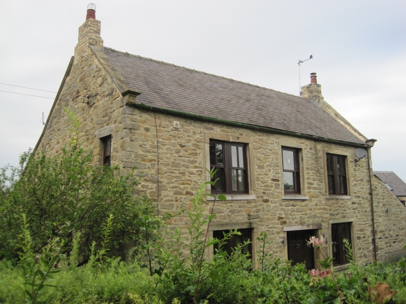
Latitude: 54.8941 / 54°53'38"N
Longitude: -1.8396 / 1°50'22"W
OS Eastings: 410383
OS Northings: 555496
OS Grid: NZ103554
Mapcode National: GBR HCLV.JD
Mapcode Global: WHC40.Q75Y
Plus Code: 9C6WV5V6+J4
Entry Name: Main's Farmhouse
Listing Date: 4 August 1975
Grade: II
Source: Historic England
Source ID: 1240470
English Heritage Legacy ID: 438844
ID on this website: 101240470
Location: Ebchester, County Durham, DH8
County: County Durham
Electoral Ward/Division: Leadgate and Medomsley
Parish: Non Civil Parish
Built-Up Area: Ebchester
Traditional County: Durham
Lieutenancy Area (Ceremonial County): County Durham
Church of England Parish: Ebchester
Church of England Diocese: Durham
Tagged with: Farmhouse
NZ 1055 CONSETT FRONT STREET ( East- side) Ebchester 17/47 Main's Farmhouse 4/8/75
GV II Farmhouse. Mid C18 with C20 alterations. Sandstone rubble with quoins and ashlar dressings; Welsh slate roof with stone gable copings and yellow brick chimneys. 2 storeys, 3 bays and right pent extension of one storey, one bay. Wide central doorway with renewed lintel has recessed C20 door. Plain stone surrounds to windows, wider in outer bays, with renewed glazing. Blank pent extension. Roof has moulded kneelers and right end chimney; truncated left end chimney. Rear full-height central square-plan stair turret. Probably incorporates masonry from Roman fort Vindomora in which it stands. Interior not inspected.
Listing NGR: NZ1038355496
External links are from the relevant listing authority and, where applicable, Wikidata. Wikidata IDs may be related buildings as well as this specific building. If you want to add or update a link, you will need to do so by editing the Wikidata entry.


Other nearby listed buildings