Latitude: 52.6266 / 52°37'35"N
Longitude: 0.9884 / 0°59'18"E
OS Eastings: 602358
OS Northings: 307402
OS Grid: TG023074
Mapcode National: GBR SCC.BQL
Mapcode Global: WHLSC.47YP
Plus Code: 9F42JXGQ+M9
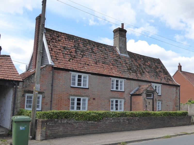
Entry Name: Church Farmhouse
Listing Date: 31 May 1991
Grade: II
Source: Historic England
Source ID: 1241238
English Heritage Legacy ID: 220901
ID on this website: 101241238
Location: Garvestone, Breckland, Norfolk, NR9
County: Norfolk
District: Breckland
Civil Parish: Garvestone
Built-Up Area: Garvestone
Traditional County: Norfolk
Lieutenancy Area (Ceremonial County): Norfolk
Church of England Parish: Garveston St Margaret
Church of England Diocese: Norwich
Tagged with: Farmhouse
The following building shall be added:-
GARVESTONE TG 00 NW DEREHAM ROAD (south-west side) 6/108 Church Farmhouse GV II
Former farmhouse. C16,extended in C17 and faced 1871 according to datestone on west gable-end. Timber frame faced and partially replaced with brick. Corrugated tile roof. Lobby entrance type pla with.off-centre axial stack. 2 storeys. Facade of 3 bays of C19 light casement windows with double horizontal glazing bars. Ground floor windows beneath square hood moulds. Catslide roof-over Circa C outshut at rear;with black glazed pantiles, on raking dormer and C casement. Interior. Evidence of original through passage to eastern end with remains of service partition. Broach chamfer stops and long emp mortices for arched head to service doorway. C17 western bay with nicked chamfer stops. Later C17 or C18 roof structure with some original tie beams surviving however.
Listing NGR: TG0235807402
External links are from the relevant listing authority and, where applicable, Wikidata. Wikidata IDs may be related buildings as well as this specific building. If you want to add or update a link, you will need to do so by editing the Wikidata entry.


Other nearby listed buildings