Latitude: 54.2367 / 54°14'12"N
Longitude: -0.7174 / 0°43'2"W
OS Eastings: 483693
OS Northings: 483093
OS Grid: SE836830
Mapcode National: GBR RMFG.H0
Mapcode Global: WHF9X.YRKY
Plus Code: 9C6X67PM+M2
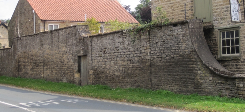
Entry Name: Wall Approximately 1.25 Metres to North of the Riding Stables
Listing Date: 5 February 1986
Grade: II
Source: Historic England
Source ID: 1241246
English Heritage Legacy ID: 440227
ID on this website: 101241246
Location: Thornton-le-Dale, North Yorkshire, YO18
County: North Yorkshire
District: Ryedale
Civil Parish: Thornton-le-Dale
Built-Up Area: Thornton-le-Dale
Traditional County: Yorkshire
Lieutenancy Area (Ceremonial County): North Yorkshire
Tagged with: Wall
SE 8383
14/120
THORNTON DALE
HIGH STREET
(south side)
Wall approximately 1.25 metres to north of The Riding Stables
GV
II
Wall to former stable yard of The Hall (qv). Late C18, partly rebuilt in
C20. Coursed sandstone rubble with ashlar coping. Approximately .75 metres
high, ramped-up twice to approximately 3.5 and 4.0 metres. Plank door to
left beneath tripartite keyed lintel. Pilaster piers and flat coping.
Rebuilt square pier with pyramidal cap to yard entrance. Included for group
value.
Listing NGR: SE8369383093
External links are from the relevant listing authority and, where applicable, Wikidata. Wikidata IDs may be related buildings as well as this specific building. If you want to add or update a link, you will need to do so by editing the Wikidata entry.


Other nearby listed buildings