Latitude: 54.2347 / 54°14'4"N
Longitude: -0.7223 / 0°43'20"W
OS Eastings: 483379
OS Northings: 482864
OS Grid: SE833828
Mapcode National: GBR RMDG.FR
Mapcode Global: WHF9X.WT7G
Plus Code: 9C6X67MH+V3
Entry Name: Roxby House
Listing Date: 5 February 1986
Grade: II
Source: Historic England
Source ID: 1241314
English Heritage Legacy ID: 440319
ID on this website: 101241314
Location: Thornton-le-Dale, North Yorkshire, YO18
County: North Yorkshire
District: Ryedale
Civil Parish: Thornton-le-Dale
Built-Up Area: Thornton-le-Dale
Traditional County: Yorkshire
Lieutenancy Area (Ceremonial County): North Yorkshire
Tagged with: House
This list entry was subject to a Minor Amendment on 11 February 2026 to correct a typo in the description and to format the text to current standards
SE 8382
15/138
THORNTON DALE
MALTONGATE (west side)
Roxby House
GV
II
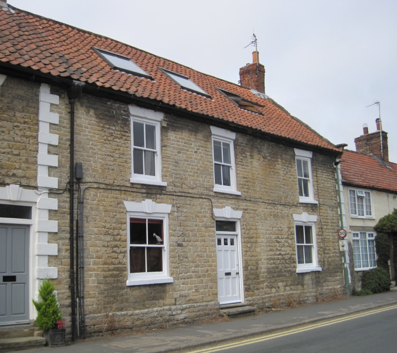
House. Early C19. Dressed sandstone on plinth with painted raised quoins; timber eaves cornice; pantile roof; brick stacks. Central stairhall plan, one room deep. Two storey symmetrical three window front. Central six-panel door with three small lights and overlight. Four-pane sashes with painted stone sills throughout. Triple keyed wedge lintels to all openings. Moulded eaves course. Three inserted roof lights. Coped gable and shaped kneeler to right. End stacks.
Listing NGR: SE8337982864
External links are from the relevant listing authority and, where applicable, Wikidata. Wikidata IDs may be related buildings as well as this specific building. If you want to add or update a link, you will need to do so by editing the Wikidata entry.


Other nearby listed buildings