Approximate Location Map
Large Map »
Latitude: 54.2339 / 54°14'2"N
Longitude: -0.7224 / 0°43'20"W
OS Eastings: 483374
OS Northings: 482774
OS Grid: SE833827
Mapcode National: GBR RMDH.D0
Mapcode Global: WHF9X.WV53
Plus Code: 9C6X67MH+H2
Entry Name: Rorty Crankle
Listing Date: 5 February 1986
Grade: II
Source: Historic England
Source ID: 1260576
English Heritage Legacy ID: 440315
ID on this website: 101260576
Location: Thornton-le-Dale, North Yorkshire, YO18
County: North Yorkshire
District: Ryedale
Civil Parish: Thornton-le-Dale
Built-Up Area: Thornton-le-Dale
Traditional County: Yorkshire
Lieutenancy Area (Ceremonial County): North Yorkshire
Tagged with: Architectural structure
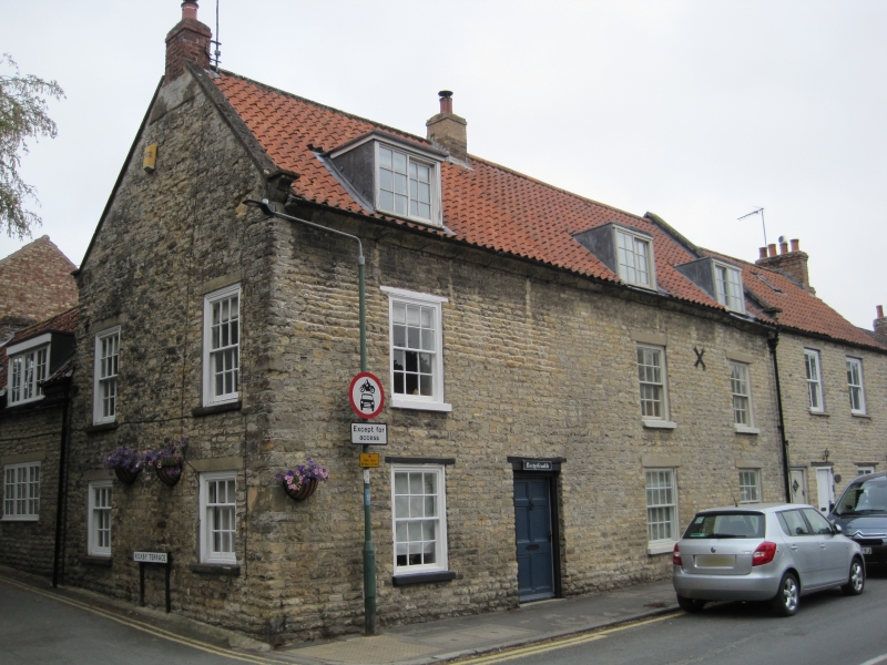
THORNTON DALE MALTONGATE
SE 8382
(west side)
15/134 Rorty Crankle
GV II
House. Late C18 with later alteration. Squared sandstone with pantile roof
and brick stacks. 3-cell, hearth-passage plan with rear wing to left.
2 storeys and attic. C20 6-panel door to centre left with 16-pane sash to
right; 12-pane sashes to end left and end right. Three 12-pane sashes to
first floor, and 3 inserted flat-topped dormers to attic. Painted stone
sills to all windows. Thin timber lintels to door and openings to left;
renewed, rendered lintels to openings to right. Cavetto moulded eaves
cornice. Coped gables and shaped kneelers. End left and left of centre
stacks.
Listing NGR: SE8337482774
External links are from the relevant listing authority and, where applicable, Wikidata. Wikidata IDs may be related buildings as well as this specific building. If you want to add or update a link, you will need to do so by editing the Wikidata entry.


Other nearby listed buildings
