Latitude: 51.1512 / 51°9'4"N
Longitude: 0.2204 / 0°13'13"E
OS Eastings: 555387
OS Northings: 141448
OS Grid: TQ553414
Mapcode National: GBR MPJ.NKF
Mapcode Global: VHHQC.RBVB
Plus Code: 9F32562C+F4
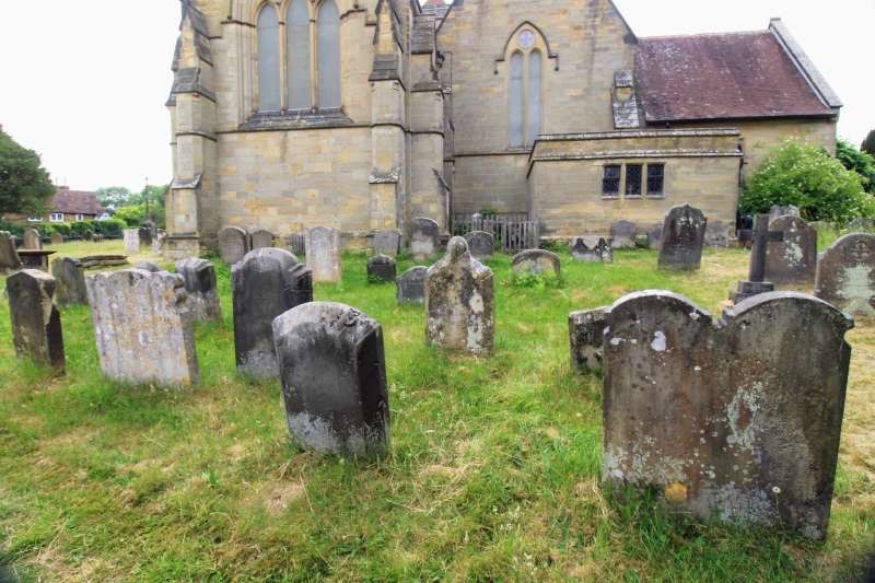
Entry Name: Scattered Group of 4 C18 Headstones Between 6-18 Metres East of the Chancel of the Church of St Mary the Virgin
Listing Date: 24 August 1990
Grade: II
Source: Historic England
Source ID: 1241529
English Heritage Legacy ID: 440628
ID on this website: 101241529
Location: St Mary's Church, Speldhurst, Tunbridge Wells, Kent, TN3
County: Kent
District: Tunbridge Wells
Civil Parish: Speldhurst
Built-Up Area: Speldhurst
Traditional County: Kent
Lieutenancy Area (Ceremonial County): Kent
Church of England Parish: Speldhurst St Mary the Virgin
Church of England Diocese: Rochester
Tagged with: Tombstone
TQ 55 41 SPELDHURST SPELDHURST HILL (north side), SPELDHURST 12/580 Scattered group of 4 C18 headstones between 6-18m east of the chancel of the Church of St Mary the Virgin GV II
Group of 4 headstones. All are C18. All are upright sandstone slabs standing ebtween 300-600mm high. Nearest the church is the smallest with its head curving over a carved rosette. Inscription (as with the other 3) is in Roman serif upper and lower case lettering and records the death of William Camfield in 1767. There is another very similar in memory of Elizabeth Weller (died 1770). The third has a double curvilinear shaped head, each inscribed with crossed arrows, above a fielded panel. This one commemorates the death of John Richardson (date buried). The fourth has a shaped head inscribed with crossed arrows flanked by hearts. It records the death of Thomas Dine in 1763.
Listing NGR: TQ5538741448
External links are from the relevant listing authority and, where applicable, Wikidata. Wikidata IDs may be related buildings as well as this specific building. If you want to add or update a link, you will need to do so by editing the Wikidata entry.


Other nearby listed buildings