Approximate Location Map
Large Map »
Latitude: 51.2834 / 51°17'0"N
Longitude: 1.0717 / 1°4'18"E
OS Eastings: 614302
OS Northings: 158287
OS Grid: TR143582
Mapcode National: GBR TY2.FRJ
Mapcode Global: VHLGM.J0DH
Plus Code: 9F3373MC+9M
Entry Name: St Dunstsan's Cottage
Listing Date: 3 May 1967
Grade: II
Source: Historic England
Source ID: 1241864
English Heritage Legacy ID: 441109
ID on this website: 101241864
Location: St Dunstan's, Canterbury, Kent, CT2
County: Kent
District: Canterbury
Electoral Ward/Division: Westgate
Parish: Non Civil Parish
Built-Up Area: Canterbury
Traditional County: Kent
Lieutenancy Area (Ceremonial County): Kent
Tagged with: Cottage
1.
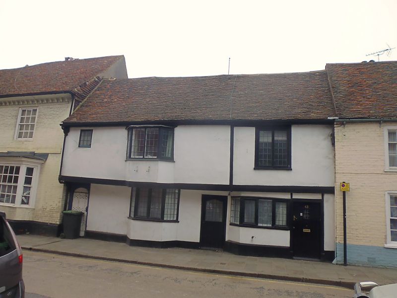
944 ST DUNSTAN'S STREET
(South West Side)
No 43
(St Dunstan's Cottage)
No 44
TR 1458 SW 1/111 3.5.67.
II GV
2.
C16 timber-framed houses with overhanging lst floor but refronted with cement.
2 storeys. 3 windows in all. No 44 has a small bay window on both floors.
Nos 39 to 45 (consec) form a group.
Listing NGR: TR1430258286
External links are from the relevant listing authority and, where applicable, Wikidata. Wikidata IDs may be related buildings as well as this specific building. If you want to add or update a link, you will need to do so by editing the Wikidata entry.


Other nearby listed buildings
