Latitude: 51.1136 / 51°6'48"N
Longitude: 1.0942 / 1°5'39"E
OS Eastings: 616670
OS Northings: 139477
OS Grid: TR166394
Mapcode National: GBR V07.1GW
Mapcode Global: VHLHD.X8BN
Plus Code: 9F33437V+CM
Entry Name: Tudor Cottage
Listing Date: 17 October 1988
Grade: II
Source: Historic England
Source ID: 1242039
English Heritage Legacy ID: 441376
ID on this website: 101242039
Location: Etchinghill, Folkestone and Hythe, Kent, CT18
County: Kent
District: Folkestone and Hythe
Civil Parish: Lyminge
Built-Up Area: Etchinghill
Traditional County: Kent
Lieutenancy Area (Ceremonial County): Kent
Tagged with: Cottage
TR 13 NE LYMINGE CANTERBURY ROAD (south-west side)
6/149 Etchinghill Tudor Cottage
GV II
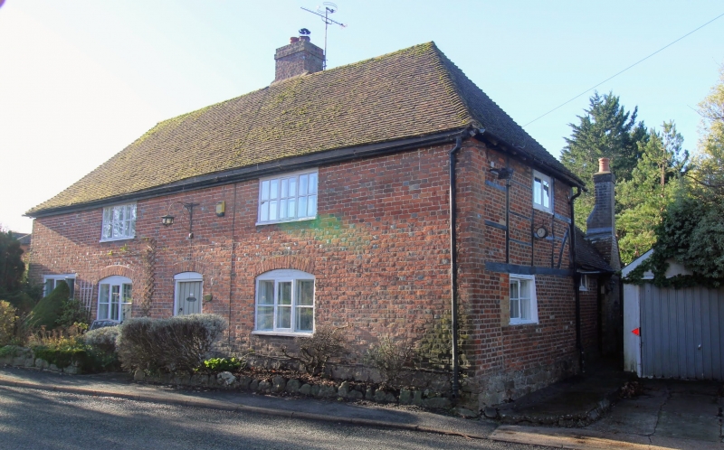
House, formerly house and shop, now house and tea-rooms. Early C17 or earlier, with C19 facade. Timber framed. Front elevation and left gable end red and grey brick in Flemish bond. Right gable end red brick on ground floor, exposed broadly-spaced studding with red and grey brick infilling to first floor. Two adjacent principal posts to rear corner, the inner one shorter and tension-braced. Plain tile roof. 2 storeys, on galleted stone plinth. Wall-plate with edge-halved scarf-joint. Hipped roof. Red and grey brick stack slightly to right of centre. Irregular fenestration of 2 three-light casements under eaves. Similar ground-floor windows with segmental heads, and a third towards left end. Ribbed door with segmental head under stack. Red and grey brick rear lean-to to left. Single-storey rear return wing to right, with hipped plain-tile roof to rear, and buff brick stack to right side, and door towards junction with main range. Interior not inspected.
Listing NGR: TR1667039477
External links are from the relevant listing authority and, where applicable, Wikidata. Wikidata IDs may be related buildings as well as this specific building. If you want to add or update a link, you will need to do so by editing the Wikidata entry.


Other nearby listed buildings