Approximate Location Map
Large Map »
Latitude: 53.3721 / 53°22'19"N
Longitude: -3.1359 / 3°8'9"W
OS Eastings: 324519
OS Northings: 386742
OS Grid: SJ245867
Mapcode National: GBR 6YJF.WX
Mapcode Global: WH766.SHWQ
Plus Code: 9C5R9VC7+VJ
Entry Name: Old Post Office
Listing Date: 20 January 1988
Grade: II
Source: Historic England
Source ID: 1242795
English Heritage Legacy ID: 443640
ID on this website: 101242795
Location: Frankby, Wirral, Merseyside, CH48
County: Wirral
Electoral Ward/Division: Greasby, Frankby and Irby
Parish: Non Civil Parish
Traditional County: Cheshire
Lieutenancy Area (Ceremonial County): Merseyside
Church of England Parish: Frankby St John the Divine
Church of England Diocese: Chester
Tagged with: Post office
SJ 28 NW HOYLAKE FRANKBY ROAD
(south side)
Frankby
4/19 Old Post Office
-
G.V. II
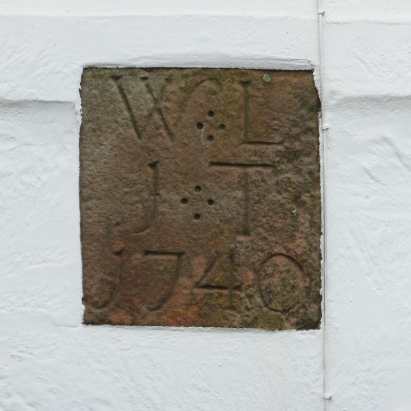
House, at one time the post office. Datestone reads:
"WL/IT/1740". Stucco with slate roof. 2 storeys, 2 bays.
2 flat bands. Windows have C20 casements; C20 door. 2
gable-end stacks and rear outshut. Interior altered in C20.
Included for group value.
Listing NGR: SJ2451986742
External links are from the relevant listing authority and, where applicable, Wikidata. Wikidata IDs may be related buildings as well as this specific building. If you want to add or update a link, you will need to do so by editing the Wikidata entry.


Other nearby listed buildings
