Latitude: 51.4215 / 51°25'17"N
Longitude: -1.7299 / 1°43'47"W
OS Eastings: 418875
OS Northings: 169196
OS Grid: SU188691
Mapcode National: GBR 4X2.TQ6
Mapcode Global: VHB46.YJTN
Plus Code: 9C3WC7CC+H2
Entry Name: The Town Hall
Listing Date: 21 October 1974
Grade: II
Source: Historic England
Source ID: 1242852
English Heritage Legacy ID: 310346
ID on this website: 101242852
Location: Marlborough, Wiltshire, SN8
County: Wiltshire
Civil Parish: Marlborough
Built-Up Area: Marlborough
Traditional County: Wiltshire
Lieutenancy Area (Ceremonial County): Wiltshire
Tagged with: City hall Seat of local government
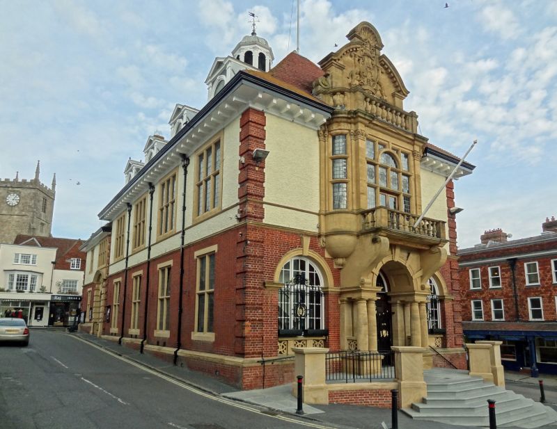
HIGH STREET 1. 5407 (East End) CENTRE ISLAND The Town Hall SU 1869 1/1 II GV 2. . 1902 C E Ponting Architect. Freehandling of William and Mary and Renaissance styles. 2 storeys, brick plinth with brick ground floor and roughcast lst floor with brick quoins and dressings. String courses of brick. Steep pitch tiled roof with projecting bracketed moulded cornice. Domed arcaded lantern on ridge. Pedimented dormers. Main front is side elevation facing down High Street. Elaborate stone centrepiece with paired squat Doric columns on pedestals with vertical entablatures as imposts to entrance arch with keystones. Heavy scrolled brackets above to large renaissance bay windows with mullioned transomed lights, balcony and parapet balustrade. Elaborate stone armorial feature above. Either side of entrance on ground floor are large round headed windows with stone imposts architrave and keystone, inset panelled balustrade below sills. Dominating position closing High Street vista. The Town Hall form a group with Nos 1 to 12 (consec) and Nos 131 to 144 (consec) and Midland Bank.
Listing NGR: SU1888069196
External links are from the relevant listing authority and, where applicable, Wikidata. Wikidata IDs may be related buildings as well as this specific building. If you want to add or update a link, you will need to do so by editing the Wikidata entry.


Other nearby listed buildings