Approximate Location Map
Large Map »
Latitude: 51.4216 / 51°25'17"N
Longitude: -1.7301 / 1°43'48"W
OS Eastings: 418866
OS Northings: 169216
OS Grid: SU188692
Mapcode National: GBR 4X2.TNV
Mapcode Global: VHB46.YJRJ
Plus Code: 9C3WC7C9+MX
Entry Name: 144, High Street
Listing Date: 18 July 1949
Grade: II
Source: Historic England
Source ID: 1258390
English Heritage Legacy ID: 310390
ID on this website: 101258390
Location: Marlborough, Wiltshire, SN8
County: Wiltshire
Civil Parish: Marlborough
Built-Up Area: Marlborough
Traditional County: Wiltshire
Lieutenancy Area (Ceremonial County): Wiltshire
Tagged with: Building
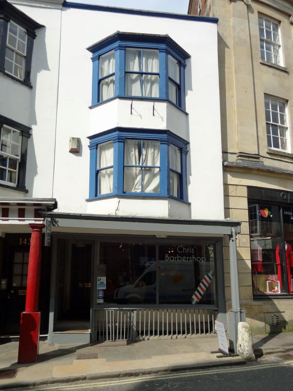
HIGH STREET
1.
5407
(North Side)
No 144
SU 1869 1/202 18.7.49.
II GV
2.
Small 3 storey extension early C19 to right hand of Mundy's repeating design
of older front. One angular bay to upper floors with same Doric surround. Small
plain Cl9 shop on ground floor.
Nos 131 to 144 (consec) and Midland Bank form a group, with the Town Hall and
Nos 1 to 12 (consec), opposite.
Listing NGR: SU1886369220
External links are from the relevant listing authority and, where applicable, Wikidata. Wikidata IDs may be related buildings as well as this specific building. If you want to add or update a link, you will need to do so by editing the Wikidata entry.


Other nearby listed buildings
