Approximate Location Map
Large Map »
Latitude: 52.1545 / 52°9'16"N
Longitude: -2.0929 / 2°5'34"W
OS Eastings: 393741
OS Northings: 250700
OS Grid: SO937507
Mapcode National: GBR 2J0.ZN0
Mapcode Global: VH932.N3YN
Plus Code: 9C4V5W34+RR
Entry Name: The White House
Listing Date: 11 February 1965
Grade: II
Source: Historic England
Source ID: 1242865
English Heritage Legacy ID: 443841
ID on this website: 101242865
Location: Peopleton, Wychavon, Worcestershire, WR10
County: Worcestershire
District: Wychavon
Civil Parish: Peopleton
Built-Up Area: Peopleton
Traditional County: Worcestershire
Lieutenancy Area (Ceremonial County): Worcestershire
Church of England Parish: Peopleton
Church of England Diocese: Worcester
Tagged with: House
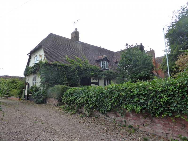
PEOPLETON PEOPLETON
1.
2301
The White House
SO 95 SW 5/554 11.2.65.
II
2.
C14 timber frame building of cruck construction and 3 bays. Refaced with
brick, now painted. Half-hipped tiled roof. Later L-wing at one end. Casement
windows. 2-storeys. 2 windows.
Listing NGR: SO9374150700
External links are from the relevant listing authority and, where applicable, Wikidata. Wikidata IDs may be related buildings as well as this specific building. If you want to add or update a link, you will need to do so by editing the Wikidata entry.


Other nearby listed buildings
