Approximate Location Map
Large Map »
Latitude: 52.1538 / 52°9'13"N
Longitude: -2.0929 / 2°5'34"W
OS Eastings: 393741
OS Northings: 250621
OS Grid: SO937506
Mapcode National: GBR 2J0.ZN8
Mapcode Global: VH932.N4Y6
Plus Code: 9C4V5W34+GR
Entry Name: Monk's Path
Listing Date: 3 August 1972
Grade: II
Source: Historic England
Source ID: 1242905
English Heritage Legacy ID: 443840
ID on this website: 101242905
Location: Peopleton, Wychavon, Worcestershire, WR10
County: Worcestershire
District: Wychavon
Civil Parish: Peopleton
Built-Up Area: Peopleton
Traditional County: Worcestershire
Lieutenancy Area (Ceremonial County): Worcestershire
Church of England Parish: Peopleton
Church of England Diocese: Worcester
Tagged with: Architectural structure
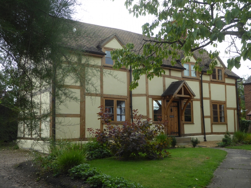
PEOPLETON PEOPLETON
1.
2301
Monk's Path
SO 95 SW 5/552
II
2.
Cl7. Timber frame and plaster. 2-storeys. 3 windows. Modern casements.
Modern door and hood. Modern dormers flush with front. New tile roof with
gable ends. Much restored.
Listing NGR: SO9374150621
External links are from the relevant listing authority and, where applicable, Wikidata. Wikidata IDs may be related buildings as well as this specific building. If you want to add or update a link, you will need to do so by editing the Wikidata entry.


Other nearby listed buildings
