Approximate Location Map
Large Map »
Latitude: 52.1528 / 52°9'9"N
Longitude: -2.0929 / 2°5'34"W
OS Eastings: 393740
OS Northings: 250503
OS Grid: SO937505
Mapcode National: GBR 2J0.ZNM
Mapcode Global: VH932.N5X0
Plus Code: 9C4V5W34+4R
Entry Name: Perry Mill Farmhouse
Listing Date: 3 August 1972
Grade: II
Source: Historic England
Source ID: 1259841
English Heritage Legacy ID: 443839
ID on this website: 101259841
Location: Peopleton, Wychavon, Worcestershire, WR10
County: Worcestershire
District: Wychavon
Civil Parish: Peopleton
Built-Up Area: Peopleton
Traditional County: Worcestershire
Lieutenancy Area (Ceremonial County): Worcestershire
Church of England Parish: Peopleton
Church of England Diocese: Worcester
Tagged with: Farmhouse
PEOPLETON PEOPLETON
1.
2301
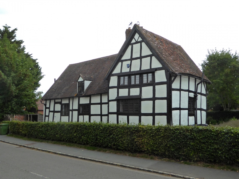
Perry Mill Farmhouse
SO 95 SW 5/551
II GV
2.
Formerly Post Office. C17. Timber frame and whitened brick cottage range
with gabled cross wing. 2-storeys. Casements. Dormer.
Queen Anne Cotttage, The Crown Inn, Rose Cottage, Bay Tree Cottage and Perry
Mill Farmhouse form a group.
Listing NGR: SO9374050503
External links are from the relevant listing authority and, where applicable, Wikidata. Wikidata IDs may be related buildings as well as this specific building. If you want to add or update a link, you will need to do so by editing the Wikidata entry.


Other nearby listed buildings
