Latitude: 53.8571 / 53°51'25"N
Longitude: -2.1699 / 2°10'11"W
OS Eastings: 388919
OS Northings: 440113
OS Grid: SD889401
Mapcode National: GBR FR9V.02
Mapcode Global: WHB7R.M9XX
Plus Code: 9C5VVR4J+V2
Entry Name: Cross in St Bartholomews Churchyard
Listing Date: 29 January 1988
Grade: II
Source: Historic England
Source ID: 1243158
English Heritage Legacy ID: 186227
ID on this website: 101243158
Location: St Bartholomew's Church, Waterside, Pendle, Lancashire, BB8
County: Lancashire
District: Pendle
Civil Parish: Colne
Built-Up Area: Colne
Traditional County: Lancashire
Lieutenancy Area (Ceremonial County): Lancashire
Church of England Parish: Colne St Bartholomew
Church of England Diocese: Blackburn
Tagged with: Churchyard cross
This list entry was subject to a Minor Amendment on 16 December 2024 to correct a typo in the name and address and to reformat the text to current standards
SD 84 SE
7/258
COLNE
CHURCH STREET (north side)
Cross in St Bartholomew's Churchyard
GV
II
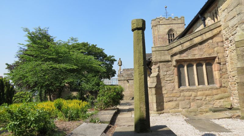
Cross, medieval. Stone. Large square block dressed only on upper side, from which rises a shaft splayed back to an octagon, crowned by a wider octagonal block some faces of which appear to be carved.
Listing NGR: SD8891940113
External links are from the relevant listing authority and, where applicable, Wikidata. Wikidata IDs may be related buildings as well as this specific building. If you want to add or update a link, you will need to do so by editing the Wikidata entry.


Other nearby listed buildings