Approximate Location Map
Large Map »
Latitude: 51.2495 / 51°14'58"N
Longitude: 0.227 / 0°13'37"E
OS Eastings: 555521
OS Northings: 152391
OS Grid: TQ555523
Mapcode National: GBR MNC.Q6P
Mapcode Global: VHHPS.WVCJ
Plus Code: 9F3266XG+QR
Entry Name: Garden Wall in Front of Black Charles
Listing Date: 16 January 1975
Grade: II
Source: Historic England
Source ID: 1243523
English Heritage Legacy ID: 447436
ID on this website: 101243523
Location: Underriver, Sevenoaks, Kent, TN15
County: Kent
District: Sevenoaks
Civil Parish: Seal
Traditional County: Kent
Lieutenancy Area (Ceremonial County): Kent
Church of England Parish: Underriver St Margaret
Church of England Diocese: Rochester
Tagged with: Wall
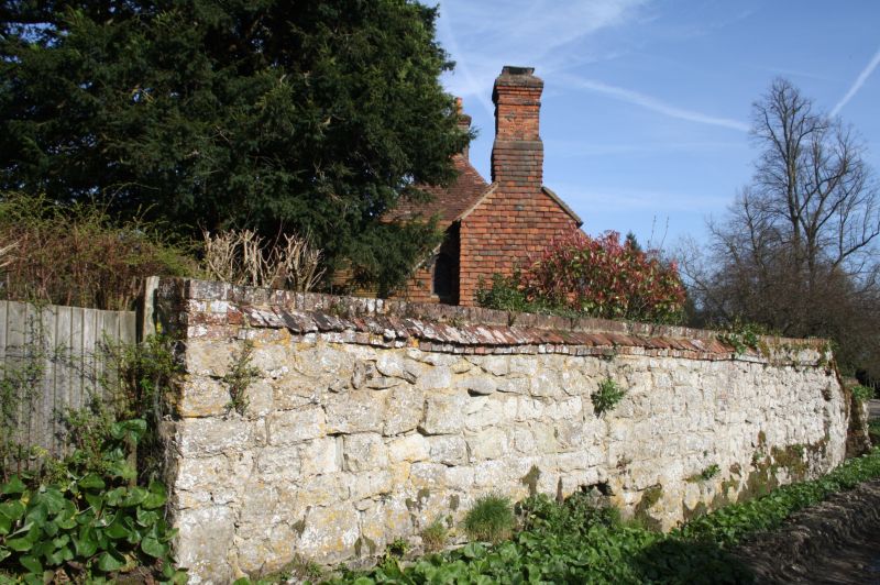
1.
5280 SEAL UNDERRIVER
Garden Wall in front
of Black Charles
TQ 5552 26/1092
II GV
2.
C17 or early C18 wall of galletted large random rubble masonry with red brick
coping.
Black Charles, Outbuilding and Wall form a group.
Listing NGR: TQ5552152391
External links are from the relevant listing authority and, where applicable, Wikidata. Wikidata IDs may be related buildings as well as this specific building. If you want to add or update a link, you will need to do so by editing the Wikidata entry.


Other nearby listed buildings
