Latitude: 51.2779 / 51°16'40"N
Longitude: 0.1209 / 0°7'15"E
OS Eastings: 548025
OS Northings: 155326
OS Grid: TQ480553
Mapcode National: GBR LLJ.TMM
Mapcode Global: VHHPR.14SQ
Plus Code: 9F3274HC+49
Entry Name: The Old Hall
Listing Date: 10 September 1954
Grade: II*
Source: Historic England
Source ID: 1243928
English Heritage Legacy ID: 448450
ID on this website: 101243928
Location: Sundridge, Sevenoaks, Kent, TN14
County: Kent
District: Sevenoaks
Civil Parish: Sundridge with Ide Hill
Built-Up Area: Sundridge
Traditional County: Kent
Lieutenancy Area (Ceremonial County): Kent
Church of England Parish: Sundridge St Mary
Church of England Diocese: Rochester
Tagged with: House
1. 5280 SUNDRIDGE SUNDRIDGE Main Road (South Side)
The Old Hall TQ 4855 32/1290 10.9.54.
II*
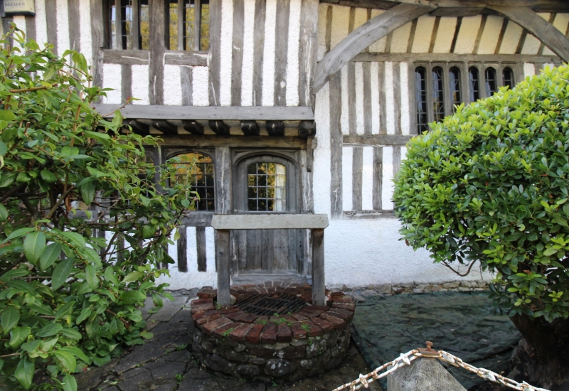
2. The "Hall House" was restored in 1926 by Professor Beresford Pite. C15. Exposed framing and vertical 1/2 timbering with rendered infilling. 2 storeys with ridge tile roof brought down as lean-to at side. Ridge stack. 1st floor oversailing at either end and supported on exposed joists. Continuous eaves and gutter supported in centre by curved angle pieces. The Hall, an unusually short one, comprising only one bay, had been divided into 2 storeys and an attic, but the floors have been taken out and the old windows with wooden mullions reinstated. An interesting feature is the old hearth, a circle of fire worn stones, which was discovered in the centre of the original hard trodden chalk floor when the later brick floor laid over it was taken up. The Inglenook fireplace and chimney date from the C17. Modern additions at either side including garage and porch entrance with screen walling of brick with random stone base and pantile coping. 2-storey brick additions to right hand side.
Listing NGR: TQ4803155324
External links are from the relevant listing authority and, where applicable, Wikidata. Wikidata IDs may be related buildings as well as this specific building. If you want to add or update a link, you will need to do so by editing the Wikidata entry.


Other nearby listed buildings