Approximate Location Map
Large Map »
Latitude: 51.2779 / 51°16'40"N
Longitude: 0.1218 / 0°7'18"E
OS Eastings: 548090
OS Northings: 155331
OS Grid: TQ480553
Mapcode National: GBR LLJ.TWB
Mapcode Global: VHHPR.248Q
Plus Code: 9F3274HC+5P
Entry Name: 199, Main Road
Listing Date: 4 July 1986
Grade: II
Source: Historic England
Source ID: 1244196
English Heritage Legacy ID: 449047
ID on this website: 101244196
Location: Sundridge, Sevenoaks, Kent, TN14
County: Kent
District: Sevenoaks
Civil Parish: Sundridge with Ide Hill
Built-Up Area: Sundridge
Traditional County: Kent
Lieutenancy Area (Ceremonial County): Kent
Church of England Parish: Sundridge St Mary
Church of England Diocese: Rochester
Tagged with: Building
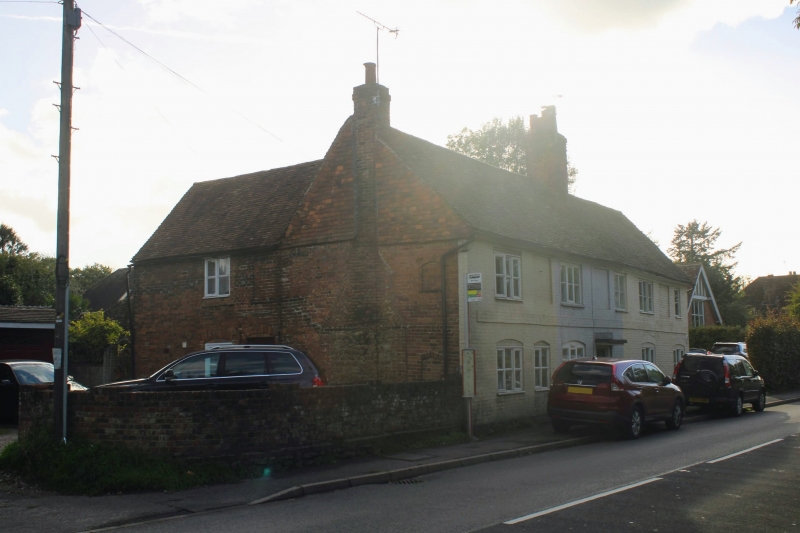
1.
SUNDRIDGE MAIN ROAD
No. 199
TQ 4855 32/1476
II GV
2.
Cottage, part of a row of three cottages. Mid C18, refenestrated in C19 and with C20
alterations. Red brick, painted on front elevation and with tile hung gable to left end.
Tiled roof with end brick chimney-stack. L-shaped building of two storeys two windows.
First floor has one triple C19 casement and one blank, ground floor has triple C19
casement with cambered head and single light sash with cambered head and no glazing
bars probably replacing doorcase. Moulded wooden eaves cornice and plat band. Plinth.
Left side elevation has two blocked cambered headed windows and the outline of the end
chimney stack, stone to base, brick above. C20 glazed, penticed wooden porch in 2 storey
brick L wing to left. Rear elevation has tile hung gable and altered windows.
Listing NGR: TQ4809055331
External links are from the relevant listing authority and, where applicable, Wikidata. Wikidata IDs may be related buildings as well as this specific building. If you want to add or update a link, you will need to do so by editing the Wikidata entry.


Other nearby listed buildings
