Approximate Location Map
Large Map »
Latitude: 51.089 / 51°5'20"N
Longitude: -0.7073 / 0°42'26"W
OS Eastings: 490634
OS Northings: 132981
OS Grid: SU906329
Mapcode National: GBR DCS.N0F
Mapcode Global: FRA 96D7.Q9K
Plus Code: 9C3X37QV+H3
Entry Name: The Old Town Well
Listing Date: 30 July 1974
Grade: II
Source: Historic England
Source ID: 1244621
English Heritage Legacy ID: 449587
ID on this website: 101244621
Location: Haslemere, Waverley, Surrey, GU27
County: Surrey
District: Waverley
Civil Parish: Haslemere
Built-Up Area: Haslemere
Traditional County: Surrey
Lieutenancy Area (Ceremonial County): Surrey
Church of England Parish: Haslemere
Church of England Diocese: Guildford
Tagged with: Well
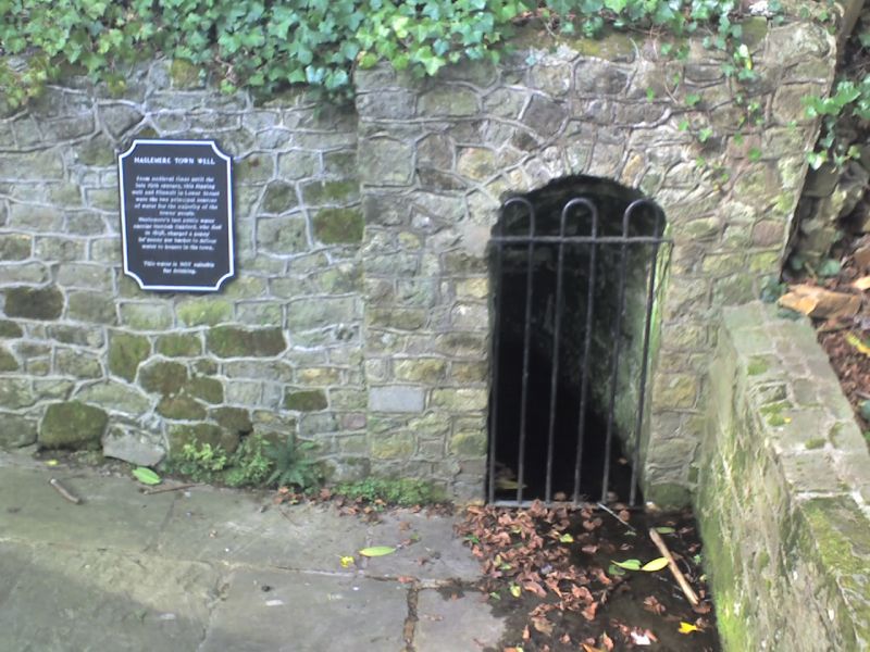
WELL LANE
1.
5393
The Old Town Well
SU 9032 NE 4/200 30.7.74.
II
2.
Probably circa C17. The well is approached by steps down into the ground between
buttressed rubble retaining walls forming a long open roofed passage. The well
is at the far end of the passage on the left and is behind an arched underground
opening containing an iron grille.
Listing NGR: SU9063432981
External links are from the relevant listing authority and, where applicable, Wikidata. Wikidata IDs may be related buildings as well as this specific building. If you want to add or update a link, you will need to do so by editing the Wikidata entry.


Other nearby listed buildings
