Latitude: 53.3854 / 53°23'7"N
Longitude: -1.458 / 1°27'28"W
OS Eastings: 436148
OS Northings: 387755
OS Grid: SK361877
Mapcode National: GBR 9KJ.Y7
Mapcode Global: WHDDP.K5YH
Plus Code: 9C5W9GPR+5R
Entry Name: The Arches and Linked Tunnel Entrance on Furnival Road
Listing Date: 8 March 1988
Grade: II
Source: Historic England
Source ID: 1247042
English Heritage Legacy ID: 456186
ID on this website: 101247042
Location: Park Hill, Sheffield, South Yorkshire, S2
County: Sheffield
Electoral Ward/Division: City
Parish: Non Civil Parish
Built-Up Area: Sheffield
Traditional County: Yorkshire
Lieutenancy Area (Ceremonial County): South Yorkshire
Church of England Parish: Park St John the Evangelist
Church of England Diocese: Sheffield
Tagged with: Architectural structure
SHEFFIELD
SK38NE CANAL WHARF 784-1/6/138 (North West side) 08/03/88 The Arches and linked tunnel entrance on Furnival Road
GV II
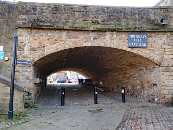
Coal staithes and tunnel below former railway coal yard. 1855, restored 1983. Built for the Manchester, Sheffield and Lincolnshire Railway Co. Rock-faced stone and rubble with ashlar dressings. String course, coped parapets. Continuous retaining wall. At the west end, a segmental skew arch. On the Furnival Road side, flanking pilasters and sloping wing walls with smaller piers, all with pyramidal caps. To the east, the wall breaks forward with 9 segmental arches, then continues in a shallow S-curve with a further 11 arches. 2 further arches demolished 1993. The tenth arch is narrower and has flanking pilasters with pyramidal caps. All arches have keystones. The vaults below the arches have girders carrying rail tracks. Coal was dropped from wagons into the vaults beneath the arches. Building vacant at time of survey.
Listing NGR: SK3614887755
External links are from the relevant listing authority and, where applicable, Wikidata. Wikidata IDs may be related buildings as well as this specific building. If you want to add or update a link, you will need to do so by editing the Wikidata entry.


Other nearby listed buildings