Latitude: 53.1542 / 53°9'15"N
Longitude: -1.5981 / 1°35'53"W
OS Eastings: 426971
OS Northings: 361968
OS Grid: SK269619
Mapcode National: GBR 58N.BRD
Mapcode Global: WHCDG.FZ6B
Plus Code: 9C5W5C32+MQ
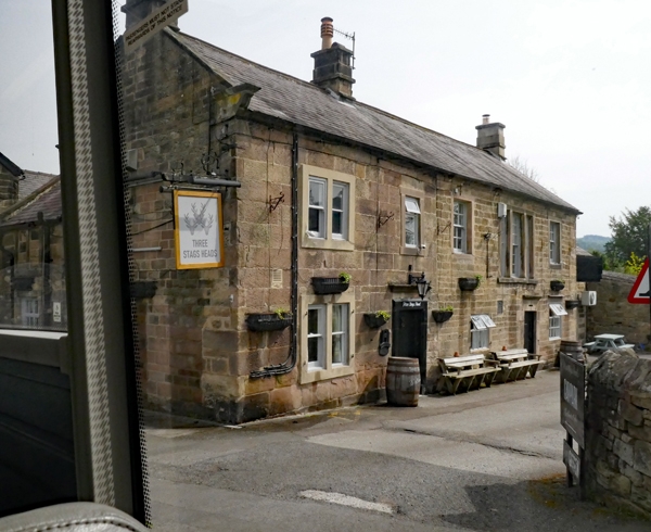
Entry Name: Three Stags Heads Public House
Listing Date: 3 October 1979
Grade: II
Source: Historic England
Source ID: 1248288
English Heritage Legacy ID: 429858
Also known as: Three Stags Heads
Three Stags Heads, Matlock
ID on this website: 101248288
Location: Darley Bridge, Derbyshire Dales, Derbyshire, DE4
County: Derbyshire
District: Derbyshire Dales
Civil Parish: South Darley
Traditional County: Derbyshire
Lieutenancy Area (Ceremonial County): Derbyshire
Church of England Parish: South Darley St Mary the Virgin
Church of England Diocese: Derby
Tagged with: Pub
1. MAIN ROAD 5175 Darley Bridge
SK 26 SE 10/157 Three Stags Heads Public House
II
2 1736 (Scratch date on doorcase) but late C17 section at rear of cross wing. Building set at right angles to street. Coursed stone with slate roof. West gable end coped with kneeler. End and off centre chimneys. House of 2 builds, the later West part (at front), probably a rebuild. 2½ storeys (attic window in gable end now blocked). 4 windows, an assortment of sashes of 1, 2 and 3 lights generally with stone band surrounds and square section mullions; about half retain glazing bars. 2 doors both with moulded dripstones, the western with painted stone surround, the eastern has massive quoined surround. C17 blocked fenestration to rear of western cross wing. Interior has good fireplace to west room ground floor with segmental arch with voussoirs and keystone.
Listing NGR: SK2697161968
External links are from the relevant listing authority and, where applicable, Wikidata. Wikidata IDs may be related buildings as well as this specific building. If you want to add or update a link, you will need to do so by editing the Wikidata entry.


Other nearby listed buildings