Approximate Location Map
Large Map »
Latitude: 51.5878 / 51°35'16"N
Longitude: -0.1164 / 0°6'59"W
OS Eastings: 530588
OS Northings: 189344
OS Grid: TQ305893
Mapcode National: GBR FM.RB3
Mapcode Global: VHGQL.XCT3
Plus Code: 9C3XHVQM+4C
Entry Name: Cattle Trough
Listing Date: 17 October 1995
Grade: II
Source: Historic England
Source ID: 1249715
English Heritage Legacy ID: 431921
ID on this website: 101249715
Location: Hornsey, Haringey, London, N8
County: London
District: Haringey
Electoral Ward/Division: Hornsey
Parish: Non Civil Parish
Built-Up Area: Haringey
Traditional County: Middlesex
Lieutenancy Area (Ceremonial County): Greater London
Church of England Parish: St Mary with St George Hornsey
Church of England Diocese: London
Tagged with: Manger
TQ 3089
800-/23/10034
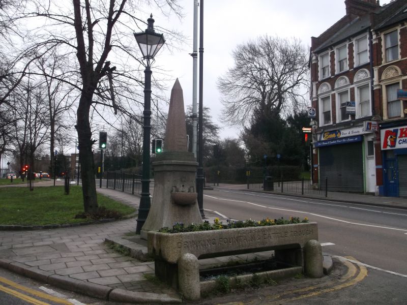
HIGH STREET, HORNSEY
Cattle trough
II
Cattle trough. Late C19. Granite rectangular trough with chamfered base on 2 granite supports.
Inscription reads 'Metropolitan Drinking Fountain and Cattle Trough Association'. Dog trough below
and 2 domed curbing stones.
Listing NGR: TQ3058889344
External links are from the relevant listing authority and, where applicable, Wikidata. Wikidata IDs may be related buildings as well as this specific building. If you want to add or update a link, you will need to do so by editing the Wikidata entry.


Other nearby listed buildings
