Latitude: 53.913 / 53°54'46"N
Longitude: -1.7133 / 1°42'48"W
OS Eastings: 418927
OS Northings: 446352
OS Grid: SE189463
Mapcode National: GBR JRG6.V1
Mapcode Global: WHC8Q.NXB3
Plus Code: 9C5WW77P+5M
Entry Name: Outbuildings to West of Throstle Nest Farmhouse
Listing Date: 8 July 1974
Grade: II
Source: Historic England
Source ID: 1250559
English Heritage Legacy ID: 432970
ID on this website: 101250559
Location: Leeds, West Yorkshire, LS21
County: Leeds
Civil Parish: Otley
Built-Up Area: Otley
Traditional County: Yorkshire
Lieutenancy Area (Ceremonial County): West Yorkshire
Church of England Parish: Otley All Saints
Church of England Diocese: Leeds
Tagged with: Appendage
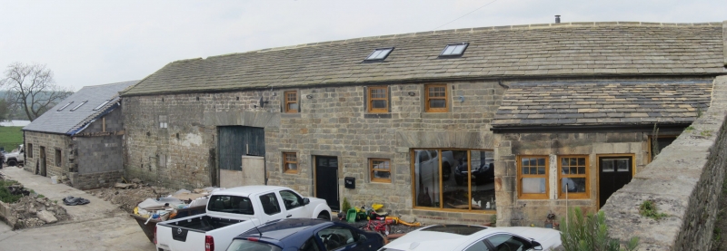
Weston Lane 1. 1480 (South Side) Outbuildings to West of Throstle Nest Farmhouse SE 14 NE 7/55A II GV 2. One outbuilding to West of the house and of same date. Stone. Stone slate roof with kneelers. Stone architraves to doors and windows. Arched entry with stone voussoirs. Penticed extension to right. Another outhouse of two storeys in stone near South-West corner of the house. One chimney. Two windows in stone architraves. Stone slate roof. Kneelers. Door in stone architrave up flight of steps in gable end. Included as a group with the Farmhouse.
Throstle Nest Farmhouse and outbuildings form a group.
Listing NGR: SE1892746352
External links are from the relevant listing authority and, where applicable, Wikidata. Wikidata IDs may be related buildings as well as this specific building. If you want to add or update a link, you will need to do so by editing the Wikidata entry.


Other nearby listed buildings