Latitude: 53.8779 / 53°52'40"N
Longitude: -1.7049 / 1°42'17"W
OS Eastings: 419497
OS Northings: 442455
OS Grid: SE194424
Mapcode National: GBR JRJL.PM
Mapcode Global: WHC8X.SSBG
Plus Code: 9C5WV7HW+52
Entry Name: Upper End Farmhouse
Listing Date: 7 April 1988
Grade: II
Source: Historic England
Source ID: 1251081
English Heritage Legacy ID: 433687
ID on this website: 101251081
Location: Guiseley, Leeds, West Yorkshire, LS20
County: Leeds
Electoral Ward/Division: Guiseley and Rawdon
Parish: Non Civil Parish
Built-Up Area: Guiseley
Traditional County: Yorkshire
Lieutenancy Area (Ceremonial County): West Yorkshire
Church of England Parish: Guiseley St Oswald King and Martyr
Church of England Diocese: Leeds
Tagged with: Farmhouse
AIREBOROUGH TOWN STREET SE 14 SE LS 20 (east side) Guiseley 4/76 No. 58 - (Upper End Farmhouse) GV II
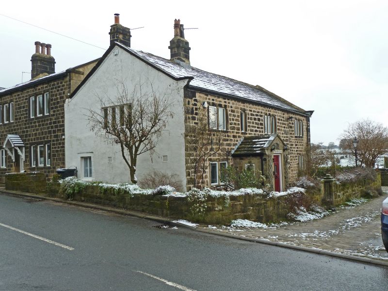
Farmhouse, now house. Dated 1743 on porch; extended and altered. Coursed squared sandstone with quoins, stone slate roof (facade now strap-pointed, gable rendered). Two-unit central-lobby-entry plan, with 3rd unit added at right-hand end. Gable to road. Two storeys, formerly almost symmetrical; rebuilt single-storey porch offset slightly left of centre, with re-cut datestone inscribed " I "; single-light window at 1st floor above the W S 1743 porch, otherwise 2 windows on each floor, and one on each floor of the addition to the right, all with plain surrounds, flat-faced flush mullions and mostly of 3 lights but those to the left of the porch of 2 slightly wider lights. Ridge chimney in line with porch, gable copings with kneelers. Left gable wall has a 3-light window at 1st floor.
Interior: back-to-back rectangular stone fireplaces, that in the right-hand room with a bread oven to the right; vaulted cellar beneath added part at right-hand end; otherwise altered. (Nos. 60 and 62 abut rear wall; q.v.).
Listing NGR: SE1949742455
External links are from the relevant listing authority and, where applicable, Wikidata. Wikidata IDs may be related buildings as well as this specific building. If you want to add or update a link, you will need to do so by editing the Wikidata entry.


Other nearby listed buildings