Latitude: 54.5634 / 54°33'48"N
Longitude: -0.9504 / 0°57'1"W
OS Eastings: 467965
OS Northings: 519186
OS Grid: NZ679191
Mapcode National: GBR PHTN.1Y
Mapcode Global: WHF88.CKNJ
Plus Code: 9C6XH27X+8R
Entry Name: Barn, Cart Shed and Horse Gin, 24 Metres North of Millholme Farmhouse
Listing Date: 8 September 1986
Grade: II
Source: Historic England
Source ID: 1251606
English Heritage Legacy ID: 432767
ID on this website: 101251606
Location: North Skelton, Redcar and Cleveland, North Yorkshire, TS12
County: Redcar and Cleveland
Civil Parish: Skelton and Brotton
Traditional County: Yorkshire
Lieutenancy Area (Ceremonial County): North Yorkshire
Church of England Parish: Brotton Parva St Margaret
Church of England Diocese: York
Tagged with: Barn
NZ 61NE SKELTON & BROTTON SKELTON ROAD
(off north side), Brotton
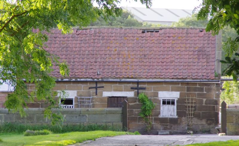
3/46 Barn, cart shed and horse
gin, 24m. north of Millholme
Farmhouse.
II
Barn mid/late C17, cart shed c.1800, and early/mid C19 horse gin. Random
rubble sandstone with dressed quoins; dressed sandstone horse gin;
hammer-dressed sandstone cart shed. Clay pantile roofs with stone gable and
ridge copings. Barn has wide flat-arched opening in west face, to left of
horse gin. Bricked-up loft doors in gable ends have wide keyed lintels
above plain lintels. Stable door in east face. Half-octagonal gin adjoins
west side of barn; no machinery. Cart shed with hayloft over, adjoins east
side of barn to form 'L'-plan range. 3 elliptical-arched openings with
voussoirs on square piers, in south face; right-hand opening altered and
blocked. Central loft door above, flanked by altered hit-and-miss openings.
North face has slit vents on ground floor and 3 altered first-floor
hit-and-miss openings. 2 hayloft windows with altered glazing in east
gable.
Listing NGR: NZ6796519186
External links are from the relevant listing authority and, where applicable, Wikidata. Wikidata IDs may be related buildings as well as this specific building. If you want to add or update a link, you will need to do so by editing the Wikidata entry.


Other nearby listed buildings