Approximate Location Map
Large Map »
Latitude: 51.2801 / 51°16'48"N
Longitude: 1.0817 / 1°4'54"E
OS Eastings: 615015
OS Northings: 157945
OS Grid: TR150579
Mapcode National: GBR TY2.Q9C
Mapcode Global: VHLGM.P3P1
Plus Code: 9F3373JJ+2M
Entry Name: Wall and Gate Piers Between Archbishop's Palace and Cathedral
Listing Date: 7 September 1973
Grade: II
Source: Historic England
Source ID: 1252881
English Heritage Legacy ID: 170538
ID on this website: 101252881
Location: Canterbury, Kent, CT1
County: Kent
District: Canterbury
Electoral Ward/Division: Westgate
Parish: Non Civil Parish
Built-Up Area: Canterbury
Traditional County: Kent
Lieutenancy Area (Ceremonial County): Kent
Tagged with: Wall
1.
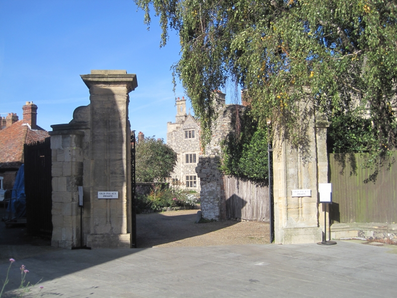
944 THE CATHEDRAL PRECINCTS
Wall and gate piers
between Archbishop's Palace
and Cathedral
TR 1557 NW 5/2B
II
2.
This incorporates Mediaeval Masonry. 1 foot high of flint and ashlar with
stone coping. Pair of stone gatepiers about 20 feet high having cornices
with Ovolo moulding.
Listing NGR: TR1500457944
External links are from the relevant listing authority and, where applicable, Wikidata. Wikidata IDs may be related buildings as well as this specific building. If you want to add or update a link, you will need to do so by editing the Wikidata entry.


Other nearby listed buildings
