Approximate Location Map
Large Map »
Latitude: 51.2802 / 51°16'48"N
Longitude: 1.0822 / 1°4'55"E
OS Eastings: 615048
OS Northings: 157959
OS Grid: TR150579
Mapcode National: GBR TY2.QDL
Mapcode Global: VHLGM.P2YY
Plus Code: 9F3373JJ+3V
Entry Name: Cloister to Christchurch Cathedral
Listing Date: 3 December 1949
Grade: I
Source: Historic England
Source ID: 1085062
English Heritage Legacy ID: 170529
ID on this website: 101085062
Location: Christ Church Cathedral, Canterbury, Kent, CT1
County: Kent
District: Canterbury
Electoral Ward/Division: Westgate
Parish: Non Civil Parish
Built-Up Area: Canterbury
Traditional County: Kent
Lieutenancy Area (Ceremonial County): Kent
Tagged with: Architectural structure
1.
170529
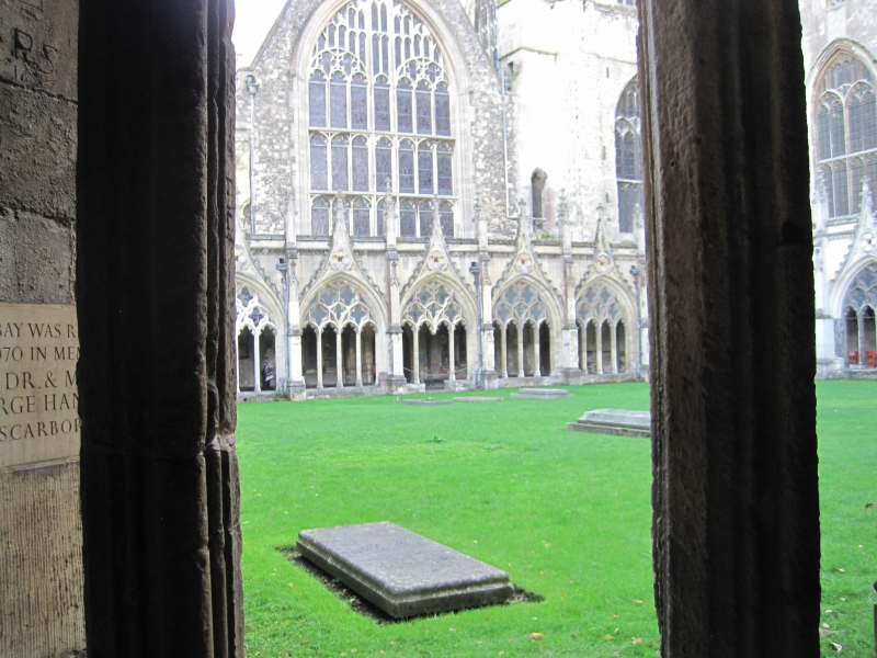
856/5/1A THE CATHEDRAL PRECINCTS
03-DEC-49 CLOISTER TO CHRISTCHURCH CATHEDRAL
GV I
2.
This was originally the Great Cloister to the monastery of Christ Church, Rebuilt under Prior Chillenden (1390-1411). Lierne vaults with very fine heraldic bosses.
Listing NGR: TR1504857960
External links are from the relevant listing authority and, where applicable, Wikidata. Wikidata IDs may be related buildings as well as this specific building. If you want to add or update a link, you will need to do so by editing the Wikidata entry.


Other nearby listed buildings
