Latitude: 52.9342 / 52°56'3"N
Longitude: -0.609 / 0°36'32"W
OS Eastings: 493586
OS Northings: 338328
OS Grid: SK935383
Mapcode National: GBR DPZ.2TG
Mapcode Global: WHGKH.MH5X
Plus Code: 9C4XW9MR+M9
Entry Name: Well Head in Belton Park
Listing Date: 20 September 1984
Grade: II
Source: Historic England
Source ID: 1253279
English Heritage Legacy ID: 436373
ID on this website: 101253279
Location: South Kesteven, Lincolnshire, NG32
County: Lincolnshire
District: South Kesteven
Civil Parish: Londonthorpe and Harrowby Without
Built-Up Area: Grantham
Traditional County: Lincolnshire
Lieutenancy Area (Ceremonial County): Lincolnshire
Church of England Parish: Grantham Londonthorpe
Church of England Diocese: Lincoln
Tagged with: Well
SK 93 NW LONDONTHORPE & HARROWBY LONDONTHORPE ROAD
WITHOUT
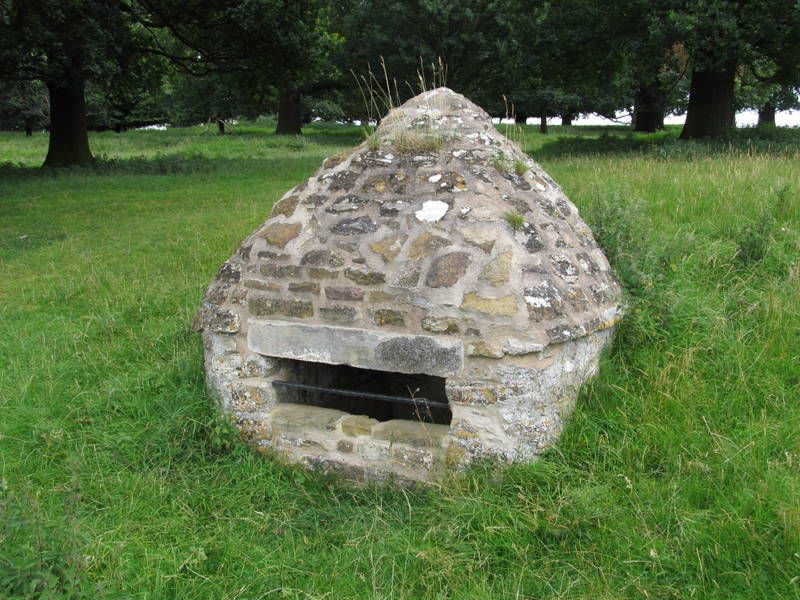
1/47 Well Head in Belton Park
Londonthorpe
G.V. II
Well head; early C19; coursed rubble limestone. Small domed structure
built into the side of the hill. Entrance now blocked.
Listing NGR: SK9358638328
External links are from the relevant listing authority and, where applicable, Wikidata. Wikidata IDs may be related buildings as well as this specific building. If you want to add or update a link, you will need to do so by editing the Wikidata entry.


Other nearby listed buildings