Latitude: 52.709 / 52°42'32"N
Longitude: -2.7557 / 2°45'20"W
OS Eastings: 349039
OS Northings: 312641
OS Grid: SJ490126
Mapcode National: GBR BJ.2G7R
Mapcode Global: WH8BT.M5ZJ
Plus Code: 9C4VP65V+JP
Entry Name: 58 and 59, Mardol
Listing Date: 10 January 1953
Grade: II
Source: Historic England
Source ID: 1254616
English Heritage Legacy ID: 457590
ID on this website: 101254616
Location: Shrewsbury, Shropshire, SY1
County: Shropshire
Civil Parish: Shrewsbury
Built-Up Area: Shrewsbury
Traditional County: Shropshire
Lieutenancy Area (Ceremonial County): Shropshire
Church of England Parish: Shrewsbury St Chad
Church of England Diocese: Lichfield
Tagged with: Building
SHREWSBURY
SJ4912NW MARDOL 653-1/11/411 (North East side) 10/01/53 Nos.58 AND 59
GV II
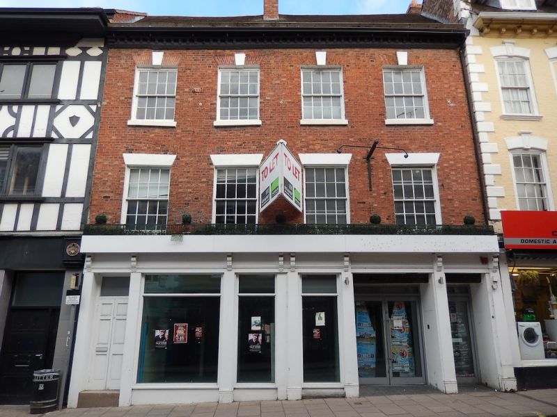
Shop and public house. c1800. Brick with plain tiled roof. 3 storeys, 4-window range with inserted shop fronts incorporating continuous late C19 fascia with console brackets. Upper windows are 12-pane sashes with flat-arched stuccoed heads to first floor, flat-arched brick heads with stressed stuccoed keys to second. Modillion eaves cornice, axial stack.
Listing NGR: SJ4903912641
External links are from the relevant listing authority and, where applicable, Wikidata. Wikidata IDs may be related buildings as well as this specific building. If you want to add or update a link, you will need to do so by editing the Wikidata entry.


Other nearby listed buildings