Latitude: 52.7065 / 52°42'23"N
Longitude: -2.7526 / 2°45'9"W
OS Eastings: 349248
OS Northings: 312358
OS Grid: SJ492123
Mapcode National: GBR BJ.2H22
Mapcode Global: WH8BT.P7GG
Plus Code: 9C4VP64W+JX
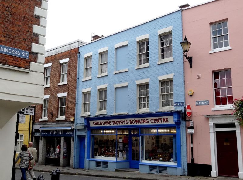
Entry Name: 5 and 6, Milk Street
Listing Date: 19 September 1972
Grade: II
Source: Historic England
Source ID: 1254658
English Heritage Legacy ID: 457687
ID on this website: 101254658
Location: Shrewsbury, Shropshire, SY1
County: Shropshire
Civil Parish: Shrewsbury
Built-Up Area: Shrewsbury
Traditional County: Shropshire
Lieutenancy Area (Ceremonial County): Shropshire
Church of England Parish: Shrewsbury St Chad
Church of England Diocese: Lichfield
Tagged with: Building
SHREWSBURY
SJ4912SW MILK STREET 653-1/15/442 (South East side) 19/09/72 Nos.5 AND 6
GV II
House, now shop and offices. Early C19 facade to possibly C17 building. Timber-framed with painted brick facade. Plain tiled roof. 2 storeys, 5-window range. Entrance to left and inserted early C20 shop front with central door recessed between windows. Upper windows are 24-pane sashes flanking wide blind central bay. Parapet.
Listing NGR: SJ4925412357
External links are from the relevant listing authority and, where applicable, Wikidata. Wikidata IDs may be related buildings as well as this specific building. If you want to add or update a link, you will need to do so by editing the Wikidata entry.


Other nearby listed buildings