Latitude: 52.9482 / 52°56'53"N
Longitude: -1.1399 / 1°8'23"W
OS Eastings: 457886
OS Northings: 339325
OS Grid: SK578393
Mapcode National: GBR LRR.B9
Mapcode Global: WHDGZ.G5D5
Plus Code: 9C4WWVX6+72
Entry Name: Turnover Bridge on Nottingham Canal
Listing Date: 30 November 1995
Grade: II
Source: Historic England
Source ID: 1254711
English Heritage Legacy ID: 457448
ID on this website: 101254711
Location: Lace Market, Nottingham, Nottinghamshire, NG2
County: City of Nottingham
Electoral Ward/Division: Bridge
Parish: Non Civil Parish
Built-Up Area: Nottingham
Traditional County: Nottinghamshire
Lieutenancy Area (Ceremonial County): Nottinghamshire
Church of England Parish: Nottingham St Saviour
Church of England Diocese: Southwell and Nottingham
Tagged with: Roving bridge
NOTTINGHAM
SK5739SE LONDON ROAD 646-1/24/331 (East side) Turnover bridge on Nottingham Canal
GV II
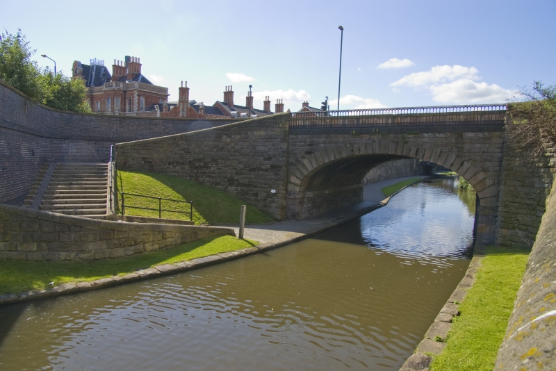
Turnover bridge carrying the access road to the London Road Railway station over the Nottingham Canal. 1792-96. By William Jessop and James Green for the Nottingham Canal Co. Probably altered 1857 when the station was built. Rockfaced stone with ashlar dressings and cast-iron balustrade. Single elliptical arch with impost band. Straight approach ramp from towpath on west side, curving ramp to east, both with half-round ashlar coping to the retaining walls. This type of bridge allows horses drawing boats to cross from one towpath to another without disconnecting the towrope. The Nottingham Canal passed into the control of the Great Northern Railway in 1861. (Canals of the British Isles: Hadfield C: Canals of the East Midlands: Newton Abbot: 1966-: 54-58 & 194-196).
Listing NGR: SK5788639324
External links are from the relevant listing authority and, where applicable, Wikidata. Wikidata IDs may be related buildings as well as this specific building. If you want to add or update a link, you will need to do so by editing the Wikidata entry.


Other nearby listed buildings