Latitude: 52.7068 / 52°42'24"N
Longitude: -2.7536 / 2°45'13"W
OS Eastings: 349177
OS Northings: 312396
OS Grid: SJ491123
Mapcode National: GBR BJ.2GRX
Mapcode Global: WH8BT.N7Y6
Plus Code: 9C4VP64W+PG
Entry Name: 23 and 23A, Princess Street
Listing Date: 10 January 1953
Grade: II
Source: Historic England
Source ID: 1254734
English Heritage Legacy ID: 457857
ID on this website: 101254734
Location: Shrewsbury, Shropshire, SY1
County: Shropshire
Civil Parish: Shrewsbury
Built-Up Area: Shrewsbury
Traditional County: Shropshire
Lieutenancy Area (Ceremonial County): Shropshire
Church of England Parish: Shrewsbury St Chad
Church of England Diocese: Lichfield
Tagged with: Building
SHREWSBURY
SJ4912SW PRINCESS STREET 653-1/15/499 (South West side) 10/01/53 Nos.23 AND 23A
GV II
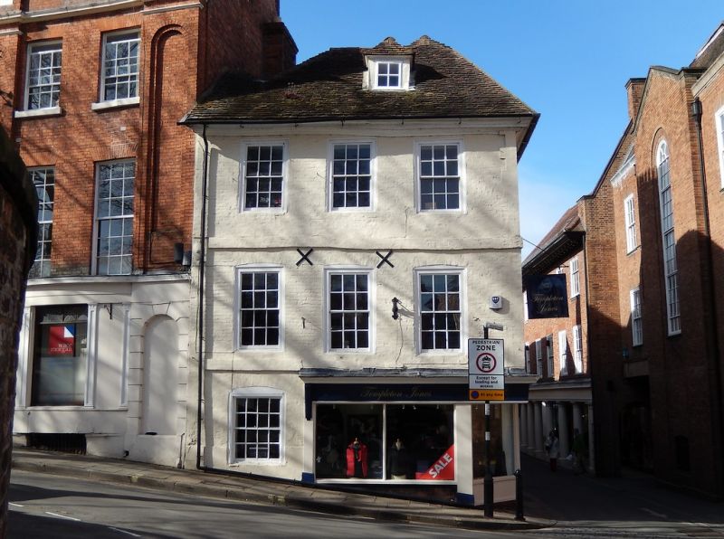
Formerly known as: No.23 PRINCESS STREET. Shop, originally dwelling. Late C17. Painted brick with exposed timber-framing in gable. Plain tiled hipped gambrel roof. 3 storeys, 4-window range to Princess Street, 3-window range to College Hill. 12-pane flush-framed sash windows with flat-arched gauged brick heads to College Hill elevation, casements with transoms to Princess Street elevation. Inserted shop fronts to ground floor, the fascia blocking lower string course. Moulded timber overhanging eaves cornice. 2 hipped dormers in roof. Rear wall stack. INTERIOR: small scantling timber-framing exposed in partition wall, and early staircase with twisted balusters and heavy moulded rail and newels.
Listing NGR: SJ4917712396
External links are from the relevant listing authority and, where applicable, Wikidata. Wikidata IDs may be related buildings as well as this specific building. If you want to add or update a link, you will need to do so by editing the Wikidata entry.


Other nearby listed buildings