Latitude: 52.707 / 52°42'25"N
Longitude: -2.7541 / 2°45'14"W
OS Eastings: 349146
OS Northings: 312417
OS Grid: SJ491124
Mapcode National: GBR BJ.2GNJ
Mapcode Global: WH8BT.N7Q2
Plus Code: 9C4VP64W+R9
Entry Name: 28 and 29, Princess Street
Listing Date: 10 January 1953
Grade: II
Source: Historic England
Source ID: 1254752
English Heritage Legacy ID: 457861
ID on this website: 101254752
Location: Shrewsbury, Shropshire, SY1
County: Shropshire
Civil Parish: Shrewsbury
Built-Up Area: Shrewsbury
Traditional County: Shropshire
Lieutenancy Area (Ceremonial County): Shropshire
Church of England Parish: Shrewsbury St Chad
Church of England Diocese: Lichfield
Tagged with: Building
SHREWSBURY
SJ4912SW PRINCESS STREET 653-1/15/502 (South West side) 10/01/53 Nos.28 AND 29
GV II
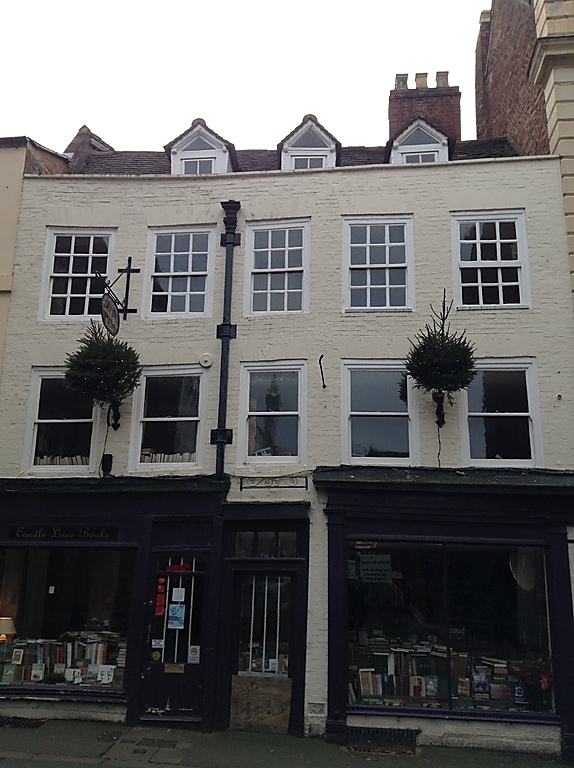
Shop, formerly 2 shops and dwellings. Early C18. Painted brick with plain tiled roof. 3 storeys, 5-window range with 2-pane sashes with flat-arched heads (12 panes to 2nd storey). Central doorway with overlight, and shop window in architrave with fascia over to the right. Shop front with doorway and window to the left. Central rainwater head with Corinthian detail. Parapet eaves, with 3 gabled dormers recessed behind. Rear wall stack.
Listing NGR: SJ4914612417
External links are from the relevant listing authority and, where applicable, Wikidata. Wikidata IDs may be related buildings as well as this specific building. If you want to add or update a link, you will need to do so by editing the Wikidata entry.


Other nearby listed buildings