Latitude: 52.9526 / 52°57'9"N
Longitude: -1.1562 / 1°9'22"W
OS Eastings: 456787
OS Northings: 339804
OS Grid: SK567398
Mapcode National: GBR LMP.SP
Mapcode Global: WHDGZ.61PS
Plus Code: 9C4WXR3V+2G
Entry Name: 30, Park Row
Listing Date: 30 November 1995
Grade: II
Source: Historic England
Source ID: 1254869
English Heritage Legacy ID: 457976
ID on this website: 101254869
Location: The Park, Nottingham, Nottinghamshire, NG1
County: City of Nottingham
Electoral Ward/Division: Radford and Park
Parish: Non Civil Parish
Built-Up Area: Nottingham
Traditional County: Nottinghamshire
Lieutenancy Area (Ceremonial County): Nottinghamshire
Church of England Parish: Nottingham St Peter with St James
Church of England Diocese: Southwell and Nottingham
Tagged with: Building
NOTTINGHAM
SK5639NE PARK ROW 646-1/19/465 (West side) No.30
GV II
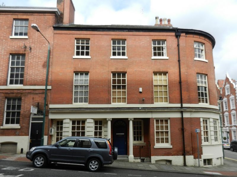
Town house, now offices. Early C19, altered late C19 and restored mid C20. Brick with painted ashlar dressings and gabled and hipped slate roof with 2 ridge stacks. Plinth, ground floor cornice, wooden eaves band. Corner block, 3 storeys plus basement; 3:2 windows. Recessed central portico with 2 Ionic columns, covering a C20 fielded panelled door and a 2-pane sash. To left, a recessed bay window with rusticated pilasters, 3-lights. To right, a 12-pane sash. Above, three 15-pane sashes and above again, three 9-pane sashes. To right, a rebated rounded corner with basement openings and a tripartite glazing bar sash with rusticated pilasters. Above, two 15-pane sashes and above again, two 9-pane sashes.
Listing NGR: SK5678739804
External links are from the relevant listing authority and, where applicable, Wikidata. Wikidata IDs may be related buildings as well as this specific building. If you want to add or update a link, you will need to do so by editing the Wikidata entry.


Other nearby listed buildings